|
search place name
|
||
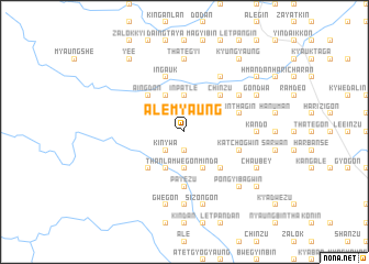
Alèmyaung (Myanmar)Alèmyaung is a town in Myanmar. An overview map of the region around Alèmyaung is displayed below.
regional and 3d topo map of Alèmyaung, Myanmar ::
Alèmyaung airports ::
The nearest airport is RGN - Yangon Intl, located 137.6 km south of Alèmyaung.
Nearby towns ::
Mangyaung (1.9km south) //
Thèwa (2.6km south west) //
Kinywa (2.6km south west) //
Inpatle (3.7km north) //
Tagundaing (3.7km south) //
Kingyi (4.0km north east) //
Gonmingwin (4.0km north east) //
Thin-in (4.1km north west) //
Gonminda (4.1km south east) //
Thanlamwe (4.1km south west) //
Thinbawdaik (4.1km south west) //
Ayaingzu (4.1km south east) //
Chinzu (5.1km north east) //
Aingdon (5.1km north west) //
Myogyaung (5.1km south west) //
Tilat (5.1km south east) //
Payèzu (5.6km south) //
Okshitkon (5.6km east) //
Kinthagin (5.6km east) //
Ingauk (5.8km north) //
Katchogwin (5.6km east) //
Thategyi Ywathit (6.6km north east) //
Mahngu (6.5km north east) //
Kāndo (7.0km east) //
Thategyi (7.4km north) //
Ngapywagyan (7.4km south) //
Gwegon (7.6km south) //
Sizongon (7.6km south) //
Ngokto (7.6km south) //
[all distances 'as the bird flies' and approximate] 
Disclaimer :: Information on this page comes without warranty of any kind |
||
|
Where is Alèmyaung? Elevation and coordinates ::
Latitude (lat): 18°6'0"N Longitude (lon): 96°30'0"E
Elevation (approx.): 50m (map arrows pan, magnifying glasses zoom) |
||
|
Visiting Alèmyaung? Hotel/Accommodation ::
Book a hotel in Alèmyaung Travel Guide ::
Buy a travel guide for Myanmar rental cars ::
car rental offers GPS waypoint ::
download a GPX waypoint (PoI) of Alèmyaung for your GPS receiver
|
||