|
search place name
|
||
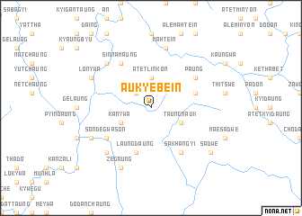
Auk Yebein (Rakhine, Myanmar)Auk Yebein is a town in the Rakhine region of Myanmar. An overview map of the region around Auk Yebein is displayed below.
regional and 3d topo map of Auk Yebein, Myanmar ::
Auk Yebein airports ::
The nearest airport is KYP - Kyaukpyu, located 64.2 km south west of Auk Yebein.
Other airports nearby include AKY - Sittwe (136.2 km west), SNW - Thandwe (137.2 km south), Nearby towns ::
Ale Linkôn (2.5km north west) //
Atet Linkôn (3.7km north) //
Kan-ywa (4.0km south west) //
Taungmauk (4.0km south east) //
Laungdaung (5.8km south) //
Paungwa (5.6km east) //
Sinnamaung (6.6km north west) //
Sondegwason (6.4km south west) //
Sakhangyi (6.6km south east) //
Paung (6.4km north east) //
Mahtein (7.6km north) //
Yeyinchaungwa (7.6km south west) //
Ngaletkya (7.6km north west) //
Zegaung (8.2km south west) //
Sakanmaw (7.9km south west) //
Lôn-ywa (7.9km north west) //
Sadwe (8.9km south east) //
[all distances 'as the bird flies' and approximate] 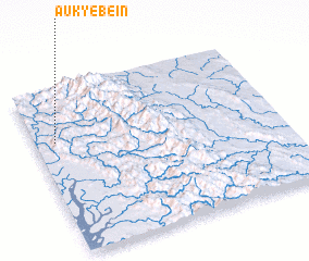 Places with similar names to Auk Yebein, Myanmar ::
// Akyiban (MM)
Disclaimer :: Information on this page comes without warranty of any kind |
||
|
Where is Auk Yebein? Elevation and coordinates ::
Latitude (lat): 19°41'0"N Longitude (lon): 94°5'0"E
Elevation (approx.): 82m (map arrows pan, magnifying glasses zoom) |
||
|
Visiting Auk Yebein? Hotel/Accommodation ::
Book a hotel in Auk Yebein Travel Guide ::
Buy a travel guide for Myanmar rental cars ::
car rental offers GPS waypoint ::
download a GPX waypoint (PoI) of Auk Yebein for your GPS receiver
|
||