|
search place name
|
||
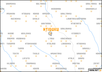
Hti-dü-ku (Kayah, Myanmar)Hti-dü-ku is a town in the Kayah region of Myanmar. An overview map of the region around Hti-dü-ku is displayed below.
regional and 3d topo map of Hti-dü-ku, Myanmar ::
Hti-dü-ku airports ::
The nearest airport is HEH - Heho, located 159.1 km north of Hti-dü-ku.
Nearby towns ::
Lyā-du (1.9km south) //
Ka-pre (2.5km north west) //
Wè-sū-daw (2.5km south west) //
Pru-so (2.5km south west) //
Lawsya (3.7km north) //
Htö-la-so (3.7km south) //
Hko-ra-hku (4.0km south east) //
Dawta-naw (4.1km north west) //
Dawsawshe (5.1km north west) //
Dawlawhku (5.6km east) //
Ma-prawse (5.6km east) //
Kawchè-hku (5.6km east) //
Dawta-htaw (5.6km east) //
Lawse-hku (6.4km south east) //
Hpu Hkyā-ku (7.6km south) //
Hpru-so (7.6km north) //
Ta-ka-lè-hso (7.6km south) //
Di-ku-le (7.6km north west) //
Lawhko-hku (8.2km north east) //
Hto-hkwi-hso (7.9km south west) //
Dawlya-hku (9.1km north east) //
Lawbya-ku (8.9km north east) //
Mo-hso (9.1km north west) //
Ti-ku-lè (9.1km south west) //
[all distances 'as the bird flies' and approximate] 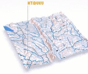 Places with similar names to Hti-dü-ku, Myanmar ::
Disclaimer :: Information on this page comes without warranty of any kind |
||
|
Where is Hti-dü-ku? Elevation and coordinates ::
Latitude (lat): 19°21'0"N Longitude (lon): 97°9'0"E
Elevation (approx.): 1281m (map arrows pan, magnifying glasses zoom) |
||
|
Visiting Hti-dü-ku? Hotel/Accommodation ::
Book a hotel in Hti-dü-ku Travel Guide ::
Buy a travel guide for Myanmar rental cars ::
car rental offers GPS waypoint ::
download a GPX waypoint (PoI) of Hti-dü-ku for your GPS receiver
|
||