|
search place name
|
||
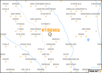
Hti-se-hku (Kayah, Myanmar)Hti-se-hku is a town in the Kayah region of Myanmar. An overview map of the region around Hti-se-hku is displayed below.
regional and 3d topo map of Hti-se-hku, Myanmar ::
Hti-se-hku airports ::
The nearest airport is HEH - Heho, located 165.4 km north of Hti-se-hku.
Nearby towns ::
Dawku-li (2.5km south east) //
Dawwi-hse (3.7km south) //
Kyebogyi (4.1km north west) //
Lawse-hku (5.2km west) //
Dawru (5.6km south) //
Kawchè-hku (5.6km west) //
Ma-prawse (5.6km west) //
Dawta-htaw (5.6km west) //
Hta-lè (6.6km south west) //
Hti-bya-nye (7.6km north) //
Hko-ra-hku (7.2km west) //
Pre-taw (7.6km south) //
Dawlawhku (7.6km north west) //
Ho-hwè-long (7.9km south east) //
Zayat (9.1km south east) //
Dawta-chè (10.2km north east) //
[all distances 'as the bird flies' and approximate] 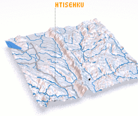 Places with similar names to Hti-se-hku, Myanmar ::
Disclaimer :: Information on this page comes without warranty of any kind |
||
|
Where is Hti-se-hku? Elevation and coordinates ::
Latitude (lat): 19°19'0"N Longitude (lon): 97°15'0"E
Elevation (approx.): 793m (map arrows pan, magnifying glasses zoom) |
||
|
Visiting Hti-se-hku? Hotel/Accommodation ::
Book a hotel in Hti-se-hku Travel Guide ::
Buy a travel guide for Myanmar rental cars ::
car rental offers GPS waypoint ::
download a GPX waypoint (PoI) of Hti-se-hku for your GPS receiver
|
||