|
search place name
|
||
Kainggyaung (Myanmar)Kainggyaung is a town in Myanmar. An overview map of the region around Kainggyaung is displayed below.
regional and 3d topo map of Kainggyaung, Myanmar ::

Kainggyaung airports ::
The nearest airport is SNW - Thandwe, located 125.0 km south west of Kainggyaung.
Other airports nearby include KYP - Kyaukpyu (189.8 km west), HEH - Heho (242.9 km north east), Nearby towns ::
Wainggyaung (1.8km east) //
Chaunggwa (2.6km south east) //
Aukchaing (4.1km south east) //
Pade (5.1km north west) //
Gwedaukmyaung (5.6km east) //
Panthinmyaing (5.8km south) //
Tangyaung (5.8km north) //
Kywethe (6.4km south west) //
Wayonzeik (6.4km south east) //
Sitsaba (7.0km west) //
Inya (7.7km south east) //
Gwegyo (8.2km north west) //
Sindok (8.2km north east) //
Momaunggya (7.9km south east) //
Indawtha (9.1km north east) //
Memyaung (8.9km north east) //
Pwetha (10.2km north west) //
[all distances 'as the bird flies' and approximate] 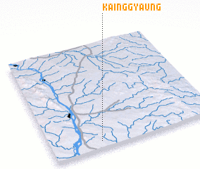 Places with similar names to Kainggyaung, Myanmar ::
// Cancayang (PH)
// Kanggyŏng (KP)
// Kanggyŏng (KR)
// Kainggyaung (MM)
// Kainggyaung (MM)
// Kainggyaung (MM)
// Kankyeng (MM)
// Köng-gyawng (MM)
// Konkyeng (MM)
// Kunkyaung (MM)
Disclaimer :: Information on this page comes without warranty of any kind |
||
|
Where is Kainggyaung? Elevation and coordinates ::
Latitude (lat): 19°4'0"N Longitude (lon): 95°18'0"E
Elevation (approx.): 101m (map arrows pan, magnifying glasses zoom) |
||
|
Visiting Kainggyaung? Hotel/Accommodation ::
Book a hotel in Kainggyaung Travel Guide ::
Buy a travel guide for Myanmar rental cars ::
car rental offers GPS waypoint ::
download a GPX waypoint (PoI) of Kainggyaung for your GPS receiver
|
||