|
search place name
|
||
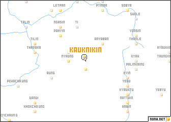
Kaukni-kin (Myanmar)Kaukni-kin is a town in Myanmar. An overview map of the region around Kaukni-kin is displayed below.
regional and 3d topo map of Kaukni-kin, Myanmar ::
Kaukni-kin airports ::
The nearest airport is MDL - Mandalay Intl, located 184.1 km east of Kaukni-kin.
Other airports nearby include AKY - Sittwe (217.5 km south west), Nearby towns ::
 Places with similar names to Kaukni-kin, Myanmar ::
// Cagangan (PH)
// Caigañgan (PH)
// Caigangan (PH)
// Kagangon (PH)
// Kākani Kona (BD)
// Kāknīkona (BD)
// Kogonoguen (BF)
// Kacangan (ID)
// Kagungan (ID)
// Kakangani (KE)
Disclaimer :: Information on this page comes without warranty of any kind |
||
|
Where is Kaukni-kin? Elevation and coordinates ::
Latitude (lat): 21°39'0"N Longitude (lon): 94°12'0"E
Elevation (approx.): 421m (map arrows pan, magnifying glasses zoom) |
||
|
Visiting Kaukni-kin? Hotel/Accommodation ::
Book a hotel in Kaukni-kin Travel Guide ::
Buy a travel guide for Myanmar rental cars ::
car rental offers GPS waypoint ::
download a GPX waypoint (PoI) of Kaukni-kin for your GPS receiver
|
||