|
search place name
|
||
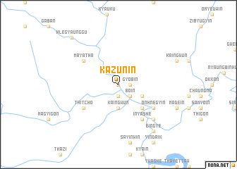
Kazun-in (Sagaing, Myanmar)Kazun-in is a town in the Sagaing region of Myanmar. An overview map of the region around Kazun-in is displayed below.
regional and 3d topo map of Kazun-in, Myanmar ::
Kazun-in airports ::
The nearest airport is IMF - Imphal, located 188.3 km north west of Kazun-in.
Other airports nearby include MDL - Mandalay Intl (227.9 km south), Nearby towns ::
Htein-in (0.0km north) //
Gyobin (1.7km east) //
Pyinbin (1.9km south) //
Bo-in (2.5km south east) //
Nyaungbinyo (2.5km south east) //
Kaingwun (3.7km south) //
Thabyetha (3.9km south east) //
Ngagyi-in (5.0km south east) //
Mayatha (6.3km north west) //
Inyashe (6.5km south east) //
Onhnegyin (6.3km south east) //
Thitcho (6.3km south west) //
Okshitpin (7.5km south east) //
Eingye (9.0km south east) //
Hlegyaunggu (10.1km north west) //
[all distances 'as the bird flies' and approximate] 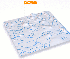 Places with similar names to Kazun-in, Myanmar ::
// Caasinan (PH)
// Cosnino (US)
// Kazanów Nowy (PL)
// Kozienin (PL)
// Kisnána (HU)
// Kuzhnen (AL)
// Kuzhnen (AL)
// Casinu Nou (RO)
// Kusunaan (RU)
// Kuzhnino (RU)
Disclaimer :: Information on this page comes without warranty of any kind |
||
|
Where is Kazun-in? Elevation and coordinates ::
Latitude (lat): 23°40'0"N Longitude (lon): 95°19'0"E
Elevation (approx.): 176m (map arrows pan, magnifying glasses zoom) |
||
|
Visiting Kazun-in? Hotel/Accommodation ::
Book a hotel in Kazun-in Travel Guide ::
Buy a travel guide for Myanmar rental cars ::
car rental offers GPS waypoint ::
download a GPX waypoint (PoI) of Kazun-in for your GPS receiver
|
||