|
search place name
|
||
Kyauksauk (Mandalay, Myanmar)Kyauksauk is a town in the Mandalay region of Myanmar. An overview map of the region around Kyauksauk is displayed below.
regional and 3d topo map of Kyauksauk, Myanmar ::

Kyauksauk airports ::
The nearest airport is MDL - Mandalay Intl, located 19.6 km north of Kyauksauk.
Other airports nearby include HEH - Heho (117.4 km south east), LSH - Lashio (238.7 km north east), Nearby towns ::
Kyauksaukkon (0.0km north) //
Ponnaywa (1.9km south) //
Kyauksaukkale (1.9km north) //
Yanbetlo (1.7km east) //
Ywatha-e (2.5km south west) //
Letpan (2.5km north east) //
Gweywa (3.7km south) //
Kyaungbandaw (4.1km south east) //
Nwadatkon (4.1km north west) //
Thodan (3.9km south east) //
Sama (3.9km north east) //
Pyawywa (5.2km west) //
Singun (5.6km north) //
Pedaw (5.2km east) //
Tanlondat (5.8km north) //
Aungtha South (5.5km west) //
Tanaungbinhla (5.5km west) //
Peleze (5.5km east) //
Aungtha (6.4km north west) //
Aungtha North (6.4km north west) //
Dayegaung (6.5km south east) //
Sizongon (7.1km west) //
Myingondaing (7.1km east) //
Mashet (7.6km south east) //
Panan (7.6km north east) //
Mogyogon (7.6km north east) //
Ywamonggyi (7.8km south east) //
Sabedaw (7.8km south east) //
Thagaya (7.8km north east) //
[all distances 'as the bird flies' and approximate] 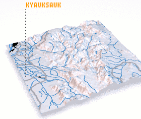 Places with similar names to Kyauksauk, Myanmar ::
// Kyakasuku (UG)
// Kyagaiseik (MM)
// Kyaiksagaw (MM)
// Kyauksauk (MM)
// Kyauksauk (MM)
// Kyaukseik (MM)
Disclaimer :: Information on this page comes without warranty of any kind |
||
|
Where is Kyauksauk? Elevation and coordinates ::
Latitude (lat): 21°32'0"N Longitude (lon): 96°2'0"E
Elevation (approx.): 82m (map arrows pan, magnifying glasses zoom) |
||
|
Visiting Kyauksauk? Hotel/Accommodation ::
Book a hotel in Kyauksauk Travel Guide ::
Buy a travel guide for Myanmar rental cars ::
car rental offers GPS waypoint ::
download a GPX waypoint (PoI) of Kyauksauk for your GPS receiver
|
||