|
search place name
|
||
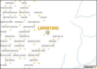
Lanpa-tang (Shan, Myanmar)Lanpa-tang is a town in the Shan region of Myanmar. An overview map of the region around Lanpa-tang is displayed below.
regional and 3d topo map of Lanpa-tang, Myanmar ::
Lanpa-tang airports ::
The nearest airport is LSH - Lashio, located 133.7 km south west of Lanpa-tang.
Other airports nearby include MYT - Myitkyina (246.2 km north west), Nearby towns ::
Ko-tang (1.7km west) //
Chē-pa (1.7km west) //
Ma-li-lin (2.5km south east) //
Ta-tung (3.9km south east) //
Hwa-tho-lin (3.9km south east) //
Pa-ka (3.9km north west) //
Pangwai (4.1km south east) //
Hsin-shui-tang (5.6km south) //
Wān Ho-tang (5.4km west) //
Yinhsin (5.8km north) //
Pang-yao-kang (5.8km south) //
Hsia-ku-chang (6.3km south west) //
Ta-kantang (6.5km south west) //
Pa-chiao-shui (6.3km north west) //
Lao-chuhkon (7.0km west) //
Pi-chiangshui (8.2km south west) //
Hsiao-kantang (8.2km south west) //
Yin-chiang-tien (8.2km north west) //
Hsinchai (8.2km north west) //
Hai-hsinshui (10.1km south west) //
Mu-kua-chai (10.1km north west) //
[all distances 'as the bird flies' and approximate] 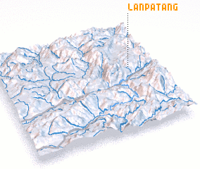 Places with similar names to Lanpa-tang, Myanmar :: Disclaimer :: Information on this page comes without warranty of any kind |
||
|
Where is Lanpa-tang? Elevation and coordinates ::
Latitude (lat): 23°38'0"N Longitude (lon): 98°51'0"E
Elevation (approx.): 1262m (map arrows pan, magnifying glasses zoom) |
||
|
Visiting Lanpa-tang? Hotel/Accommodation ::
Book a hotel in Lanpa-tang Travel Guide ::
Buy a travel guide for Myanmar rental cars ::
car rental offers GPS waypoint ::
download a GPX waypoint (PoI) of Lanpa-tang for your GPS receiver
|
||