|
search place name
|
||
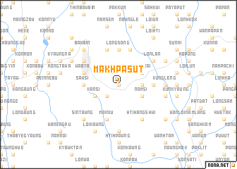
Makhpa-sut (Shan, Myanmar)Makhpa-sut is a town in the Shan region of Myanmar. An overview map of the region around Makhpa-sut is displayed below.
regional and 3d topo map of Makhpa-sut, Myanmar ::
Makhpa-sut airports ::
The nearest airport is HEH - Heho, located 30.3 km west of Makhpa-sut.
Other airports nearby include MDL - Mandalay Intl (155.8 km north west), Nearby towns ::
Kywe E (0.0km north) //
Lonwe (2.5km south west) //
Pāng Pet (3.5km east) //
Mān Hsanglek (3.5km east) //
Wabya (3.9km south west) //
Tilonpeng (3.9km south west) //
Kansi (3.9km south west) //
Namsi (3.9km south east) //
Hsai-hkai (3.9km north east) //
Chaukmaing (3.9km north east) //
Payagasu (5.2km east) //
Longsong (5.6km north) //
Sawsi (5.2km west) //
Pāngmöngnai (5.8km north) //
Mai-niu (5.8km south) //
Mawwawk (5.8km north) //
Wabya (5.5km west) //
Lonlan (6.4km north east) //
Taunggyi (6.4km north west) //
Hti-hangshwi (6.6km south east) //
Kung-leng (6.9km east) //
Htammi Hko (7.4km south) //
Kangkaw (7.2km east) //
Myothit (7.6km north west) //
Bawbin (7.6km north west) //
Sintawng (7.6km south west) //
Meng Kong (7.9km north west) //
Peinnegon (7.9km north west) //
Pa-leng (7.9km north east) //
[all distances 'as the bird flies' and approximate] 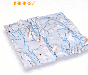 Places with similar names to Makhpa-sut, Myanmar :: Disclaimer :: Information on this page comes without warranty of any kind |
||
|
Where is Makhpa-sut? Elevation and coordinates ::
Latitude (lat): 20°45'0"N Longitude (lon): 97°5'0"E
Elevation (approx.): 1406m (map arrows pan, magnifying glasses zoom) |
||
|
Visiting Makhpa-sut? Hotel/Accommodation ::
Book a hotel in Makhpa-sut Travel Guide ::
Buy a travel guide for Myanmar rental cars ::
car rental offers GPS waypoint ::
download a GPX waypoint (PoI) of Makhpa-sut for your GPS receiver
|
||