|
search place name
|
||
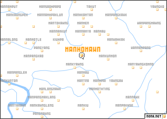
Mān Ho-mawn (Shan, Myanmar)Mān Ho-mawn is a town in the Shan region of Myanmar. An overview map of the region around Mān Ho-mawn is displayed below.
regional and 3d topo map of Mān Ho-mawn, Myanmar ::
Mān Ho-mawn airports ::
The nearest airport is KET - Kengtung, located 119.2 km south east of Mān Ho-mawn.
Other airports nearby include LSH - Lashio (150.4 km north west), MOG - Mong Hsat (181.3 km south), THL - Tachilek Tachileik (211.2 km south east), Nearby towns ::
Kāt Maw (1.9km north) //
Mān Kyawng (2.5km south west) //
Mān Maü (3.7km south) //
Mān Kūnmōn (5.2km east) //
Mān Tra (5.6km south) //
Mān Nam-ya (5.6km north) //
Kiu-hpa (6.3km north west) //
Mān Maü (6.5km north east) //
Mān Hpai (6.5km south east) //
Mān Mēn (7.4km north) //
Mān Makhkam (7.6km north) //
Mān Makkēm (7.6km north east) //
Mān Namkut (7.6km north west) //
Mān Wa-hkak (7.8km north east) //
Mān Mothting (8.2km south east) //
Mān To-kawng (9.0km north west) //
Yawng Aw (8.8km south east) //
Mān Longnawk (10.1km south west) //
[all distances 'as the bird flies' and approximate] 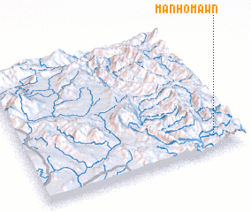 Places with similar names to Mān Ho-mawn, Myanmar ::
// Manhambane (MZ)
// Munhamane (MZ)
Disclaimer :: Information on this page comes without warranty of any kind |
||
|
Where is Mān Ho-mawn? Elevation and coordinates ::
Latitude (lat): 22°7'0"N Longitude (lon): 98°53'0"E
Elevation (approx.): 913m (map arrows pan, magnifying glasses zoom) |
||
|
Visiting Mān Ho-mawn? Hotel/Accommodation ::
Book a hotel in Mān Ho-mawn Travel Guide ::
Buy a travel guide for Myanmar rental cars ::
car rental offers GPS waypoint ::
download a GPX waypoint (PoI) of Mān Ho-mawn for your GPS receiver
|
||