|
search place name
|
||
Nawngkawlok (Shan, Myanmar)Nawngkawlok is a town in the Shan region of Myanmar. An overview map of the region around Nawngkawlok is displayed below.
regional and 3d topo map of Nawngkawlok, Myanmar ::

Nawngkawlok airports ::
The nearest airport is LSH - Lashio, located 49.1 km south west of Nawngkawlok.
Other airports nearby include KET - Kengtung (270.6 km south east), Nearby towns ::
Na-pin (0.0km north) //
Mān Kan (1.9km south) //
Konghsa (3.4km west) //
Mān Hè (3.7km north) //
Kunkawk (3.7km north) //
Loi-hsa (3.9km south west) //
Na-noi (4.1km south west) //
Kongnyawng (3.9km north west) //
Nawngheng (4.1km south east) //
Hpa-tang (3.9km north east) //
Pangna (5.0km north west) //
Nawngleng (5.6km south) //
Mān Kawng (5.1km east) //
Namnok (5.4km east) //
Pengkang (5.8km north) //
Wingke (5.4km west) //
Nawngmong (5.8km north) //
Tunhong (6.5km south west) //
Hoi-hkang (6.3km south west) //
Hwe Tawng (6.3km south east) //
Namhkam (6.8km west) //
Na-mop (6.8km west) //
Nawngsam (7.6km south) //
Namhkai (7.6km south) //
Pang-yap (7.1km west) //
Se-u (7.1km west) //
Mān Maü (7.6km south east) //
Pangkiao (7.5km north east) //
Le-lai (8.2km south west) //
[all distances 'as the bird flies' and approximate] 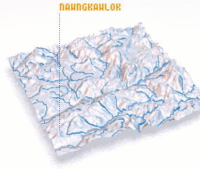 Places with similar names to Nawngkawlok, Myanmar :: Disclaimer :: Information on this page comes without warranty of any kind |
||
|
Where is Nawngkawlok? Elevation and coordinates ::
Latitude (lat): 23°17'0"N Longitude (lon): 98°6'0"E
Elevation (approx.): 767m (map arrows pan, magnifying glasses zoom) |
||
|
Visiting Nawngkawlok? Hotel/Accommodation ::
Book a hotel in Nawngkawlok Travel Guide ::
Buy a travel guide for Myanmar rental cars ::
car rental offers GPS waypoint ::
download a GPX waypoint (PoI) of Nawngkawlok for your GPS receiver
|
||