|
search place name
|
||
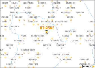
Ntīaswe (Shan, Myanmar)Ntīaswe is a town in the Shan region of Myanmar. An overview map of the region around Ntīaswe is displayed below.
regional and 3d topo map of Ntīaswe, Myanmar ::
Ntīaswe airports ::
The nearest airport is HEH - Heho, located 62.9 km north west of Ntīaswe.
Other airports nearby include MDL - Mandalay Intl (196.6 km north west), MOG - Mong Hsat (206.2 km east), Nearby towns ::
Htipwa (1.9km north) //
Htiyam (2.5km south east) //
Kyaunghkam (3.7km north) //
Wān Peng (4.1km north west) //
Namhu Pakkun (3.9km south west) //
Nammawhsenghkam (3.9km north east) //
Kyawnghke (5.1km north west) //
Loi-hsamhsip (5.1km south west) //
Wān-yin (5.1km south west) //
Mawksam (5.1km north east) //
Namme-kong (5.1km south east) //
Nānau (5.6km north) //
Pantāng (5.6km south) //
Nā-yok (5.8km north) //
Pangwe (5.8km north) //
Kyawngtet (6.4km north west) //
Nāhsehsawk (6.4km north east) //
Nā-yeng (7.6km north) //
Hsohsa (7.2km east) //
Honawng (7.6km north west) //
Nawnglat (7.6km south east) //
Namhu (8.2km south west) //
Wān-yin (8.9km north west) //
Pāngpong (9.1km north west) //
Nawngwawn (9.1km north west) //
Tawnglaw (10.2km north west) //
Könnā (10.2km north west) //
Nawnghsamwat (10.2km south west) //
Hpaknawk (10.2km north east) //
[all distances 'as the bird flies' and approximate]  Places with similar names to Ntīaswe, Myanmar ::
// Nishizawa (JP)
Disclaimer :: Information on this page comes without warranty of any kind |
||
|
Where is Ntīaswe? Elevation and coordinates ::
Latitude (lat): 20°25'0"N Longitude (lon): 97°17'0"E
Elevation (approx.): 1092m (map arrows pan, magnifying glasses zoom) |
||
|
Visiting Ntīaswe? Hotel/Accommodation ::
Book a hotel in Ntīaswe Travel Guide ::
Buy a travel guide for Myanmar rental cars ::
car rental offers GPS waypoint ::
download a GPX waypoint (PoI) of Ntīaswe for your GPS receiver
|
||