|
search place name
|
||
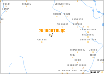
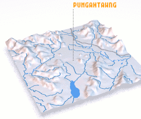
Pumgahtawng (Kachin State, Myanmar)Pumgahtawng is a town in the Kachin State region of Myanmar. An overview map of the region around Pumgahtawng is displayed below.
regional and 3d topo map of Pumgahtawng, Myanmar ::
Pumgahtawng airports ::
The nearest airport is MYT - Myitkyina, located 86.4 km east of Pumgahtawng.
Other airports nearby include PBU - Putao (215.4 km north east), MOH - Mohanbari Dibrugarh (259.7 km north west), Nearby towns ::
 Places with similar names to Pumgahtawng, Myanmar ::
// Pum-gahtawng (MM)
// Pumkahtawng (MM)
// P'imok-tong (KP)
// P'imok-tong (KP)
// P'imok-tong (KP)
// Pomak-tong (KP)
// Pomak-tong (KP)
// Pomok-tong (KR)
// P'imok-tong (KP)
// P'imok-tong (KP)
Disclaimer :: Information on this page comes without warranty of any kind |
||
|
Where is Pumgahtawng? Elevation and coordinates ::
Latitude (lat): 25°34'0"N Longitude (lon): 96°31'0"E
Elevation (approx.): 214m (map arrows pan, magnifying glasses zoom) |
||
|
Visiting Pumgahtawng? Hotel/Accommodation ::
Book a hotel in Pumgahtawng Travel Guide ::
Buy a travel guide for Myanmar rental cars ::
car rental offers GPS waypoint ::
download a GPX waypoint (PoI) of Pumgahtawng for your GPS receiver
|
||