|
search place name
|
||
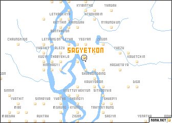
Sagyetkôn (Mandalay, Myanmar)Sagyetkôn is a town in the Mandalay region of Myanmar. An overview map of the region around Sagyetkôn is displayed below.
regional and 3d topo map of Sagyetkôn, Myanmar ::
Sagyetkôn airports ::
The nearest airport is MDL - Mandalay Intl, located 79.3 km south of Sagyetkôn.
Other airports nearby include LSH - Lashio (187.2 km east), HEH - Heho (200.9 km south east), Nearby towns ::
Zigyun (1.7km west) //
Sinthe (1.9km south) //
Sagyet (2.5km north west) //
Tôngyi (2.5km north west) //
Taung-in (2.5km north east) //
Shwedon (2.5km south east) //
Yegyan (3.7km north) //
Yedaw (4.1km north west) //
Shwegondaing (4.1km south east) //
Nyaungbinywa (4.1km south east) //
Kyauknga-nwa (3.9km south east) //
Leywa (5.0km north west) //
Zegôn (5.0km north east) //
Thabyehla (5.1km west) //
Alezu (5.5km west) //
Asugyi (5.5km west) //
Wetpaung (5.8km south) //
Hinthabo (5.5km west) //
Kaukyobon (5.8km south) //
Nyaung-ok (6.5km south east) //
Singyun (6.9km west) //
Taunggaing (7.6km north) //
Zibingon (7.6km north) //
Kaingdaw (7.6km north) //
Hinthagyi (7.1km west) //
Kyettu-ywe-kyûn (7.6km south) //
Ywezu (7.1km east) //
Magwe-taya (7.1km east) //
Bonthagon (7.6km north west) //
[all distances 'as the bird flies' and approximate] 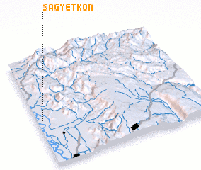 Places with similar names to Sagyetkôn, Myanmar :: Disclaimer :: Information on this page comes without warranty of any kind |
||
|
Where is Sagyetkôn? Elevation and coordinates ::
Latitude (lat): 22°25'0"N Longitude (lon): 96°2'0"E
Elevation (approx.): 76m (map arrows pan, magnifying glasses zoom) |
||
|
Visiting Sagyetkôn? Hotel/Accommodation ::
Book a hotel in Sagyetkôn Travel Guide ::
Buy a travel guide for Myanmar rental cars ::
car rental offers GPS waypoint ::
download a GPX waypoint (PoI) of Sagyetkôn for your GPS receiver
|
||