|
search place name
|
||
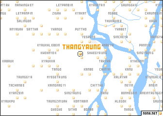
Thangyaung (Myanmar)Thangyaung is a town in Myanmar. An overview map of the region around Thangyaung is displayed below.
regional and 3d topo map of Thangyaung, Myanmar ::
Thangyaung airports ::
The nearest airport is MDL - Mandalay Intl, located 79.6 km east of Thangyaung.
Other airports nearby include HEH - Heho (188.9 km south east), Nearby towns ::
Kanthit (0.0km north) //
Shwegyaung (3.4km east) //
Nyaungzauk (3.4km east) //
Ponyin (3.7km north) //
Tadaing (3.7km south) //
Yesagyo (4.1km north east) //
Kanbe (4.1km south east) //
Pauktaw (5.2km east) //
Puttho (5.6km north) //
Kyawmakya (5.5km east) //
Tawywa (5.5km east) //
Thabyebin (5.5km west) //
Myinhlagyaung (5.5km west) //
Chinya (6.4km south east) //
Tando (6.4km south west) //
Myebyu (6.5km north west) //
Kwehmyok (6.9km west) //
Tawyakyaunggon (7.6km south) //
Kyaukhlebein (7.1km west) //
Kyaukka (7.1km west) //
Pakangyi (7.6km south) //
Sawkeba (7.6km north west) //
Ywange (7.6km north west) //
Myegetaung (7.6km south west) //
Mogwe (7.8km south east) //
Chitthu (8.2km south east) //
Thinthi (8.2km south east) //
Nyaungdaw (8.9km north west) //
Nyaungbin (8.9km north west) //
[all distances 'as the bird flies' and approximate] 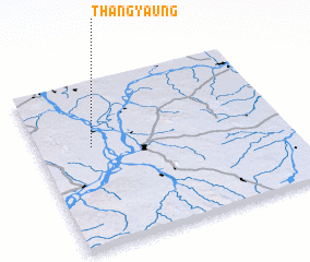 Places with similar names to Thangyaung, Myanmar ::
Disclaimer :: Information on this page comes without warranty of any kind |
||
|
Where is Thangyaung? Elevation and coordinates ::
Latitude (lat): 21°36'0"N Longitude (lon): 95°13'0"E
Elevation (approx.): 69m (map arrows pan, magnifying glasses zoom) |
||
|
Visiting Thangyaung? Hotel/Accommodation ::
Book a hotel in Thangyaung Travel Guide ::
Buy a travel guide for Myanmar rental cars ::
car rental offers GPS waypoint ::
download a GPX waypoint (PoI) of Thangyaung for your GPS receiver
|
||