|
search place name
|
||
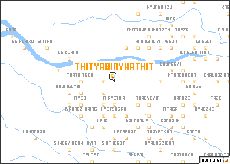
Thityabin Ywathit (Sagaing, Myanmar)Thityabin Ywathit is a town in the Sagaing region of Myanmar. An overview map of the region around Thityabin Ywathit is displayed below.
regional and 3d topo map of Thityabin Ywathit, Myanmar ::
Thityabin Ywathit airports ::
The nearest airport is MDL - Mandalay Intl, located 160.5 km south east of Thityabin Ywathit.
Other airports nearby include IMF - Imphal (240.2 km north west), Nearby towns ::
Kangalegon (1.7km west) //
Zibauk (1.7km west) //
Thitsibinhla (2.5km south west) //
Inbin-aing (2.5km south west) //
Thayetka (3.7km south) //
Kyigan (4.1km south west) //
Kayangyan (5.0km south east) //
Ywathitkon (5.1km west) //
Kyetsugan (5.6km south) //
Myauktaw (5.4km west) //
Aingya (5.8km north) //
Kaduma (5.8km south) //
Indawyo (5.8km south) //
Tanbo (6.5km north east) //
Thabyeyin (6.3km south east) //
Inye-o (6.3km south west) //
Nyaung-u (6.8km east) //
Thamèdaw (6.8km east) //
Lema (7.6km south) //
Madaiggyin (7.1km west) //
Thegon (7.6km north east) //
Hnangingyi (7.6km north east) //
Thittawbauk South (7.6km north east) //
Shwegadan (7.6km south east) //
Kyaungzin-aing (7.6km south west) //
Sanzwè (8.2km south east) //
Daunggwe (8.2km south east) //
Satpya-aing (8.2km south west) //
Okshitkon (8.2km south east) //
[all distances 'as the bird flies' and approximate] 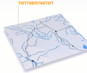 Places with similar names to Thityabin Ywathit, Myanmar :: Disclaimer :: Information on this page comes without warranty of any kind |
||
|
Where is Thityabin Ywathit? Elevation and coordinates ::
Latitude (lat): 22°59'0"N Longitude (lon): 95°15'0"E
Elevation (approx.): 169m (map arrows pan, magnifying glasses zoom) |
||
|
Visiting Thityabin Ywathit? Hotel/Accommodation ::
Book a hotel in Thityabin Ywathit Travel Guide ::
Buy a travel guide for Myanmar rental cars ::
car rental offers GPS waypoint ::
download a GPX waypoint (PoI) of Thityabin Ywathit for your GPS receiver
|
||