|
search place name
|
||
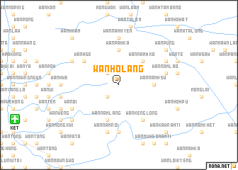
Wān Ho-lang (Shan, Myanmar)Wān Ho-lang is a town in the Shan region of Myanmar. An overview map of the region around Wān Ho-lang is displayed below.
regional and 3d topo map of Wān Ho-lang, Myanmar ::
Wān Ho-lang airports ::
The nearest airport is KET - Kengtung, located 16.2 km west of Wān Ho-lang.
Other airports nearby include THL - Tachilek Tachileik (97.2 km south), MOG - Mong Hsat (107.3 km south west), Nearby towns ::
Wān Namlin (2.5km north west) //
Wān Münhkamwai (2.5km south west) //
Wān Namhko (5.1km north east) //
Wān Pā-hkā (5.6km north) //
Wān Namhsū (5.2km east) //
Wān Namlang (5.8km south) //
Wān Hsè (6.4km north west) //
Wān Kēnglōng (6.5km south east) //
Wān Nam Myen (7.4km north) //
Wān Mawnpa-yā (7.4km south) //
Wān Namnoi (7.6km south) //
Wān Nam Lao (7.1km east) //
Wān Hkang (7.8km north west) //
Wān Oi (7.8km south west) //
Ta-lu (7.8km north east) //
Wān Namhkai (7.8km north east) //
Wān Lōm (8.9km south west) //
Wān Tawng (8.9km south west) //
Wān Püng (8.9km north east) //
Wān Hkam (10.1km north west) //
Wān Kaw Namti (10.1km south east) //
[all distances 'as the bird flies' and approximate]  Places with similar names to Wān Ho-lang, Myanmar ::
Disclaimer :: Information on this page comes without warranty of any kind |
||
|
Where is Wān Ho-lang? Elevation and coordinates ::
Latitude (lat): 21°21'0"N Longitude (lon): 99°47'0"E
Elevation (approx.): 1641m (map arrows pan, magnifying glasses zoom) |
||
|
Visiting Wān Ho-lang? Hotel/Accommodation ::
Book a hotel in Wān Ho-lang Travel Guide ::
Buy a travel guide for Myanmar rental cars ::
car rental offers GPS waypoint ::
download a GPX waypoint (PoI) of Wān Ho-lang for your GPS receiver
|
||