|
search place name
|
||
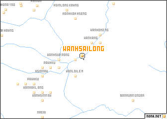
Wān Hsai-long (Shan, Myanmar)Wān Hsai-long is a town in the Shan region of Myanmar. An overview map of the region around Wān Hsai-long is displayed below.
regional and 3d topo map of Wān Hsai-long, Myanmar ::
Wān Hsai-long airports ::
The nearest airport is MOG - Mong Hsat, located 43.3 km north of Wān Hsai-long.
Other airports nearby include THL - Tachilek Tachileik (67.0 km north east), KET - Kengtung (129.8 km north), LPT - Lampang (208.3 km south), Nearby towns ::
Wān A-mat (1.7km west) //
Wān Yai (1.7km west) //
Wān Hsupyawn (1.7km west) //
Wān Kang (4.1km north east) //
Wān Loi-lem (4.1km south west) //
Möng Yawn (5.1km north east) //
Wān Hsuppöng (5.2km west) //
Wān Hwè-hā (5.5km west) //
Wān Hsinnaw (5.5km west) //
Wān Pong (5.5km west) //
Wān Ho-möng (6.6km north east) //
Li-hsā (7.2km west) //
Hsinhkamhaw (7.2km west) //
Pawhku (7.2km west) //
Wān Hsinlongmonsai (10.2km south west) //
[all distances 'as the bird flies' and approximate] 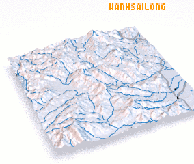 Places with similar names to Wān Hsai-long, Myanmar ::
// Wān Hsai-long (MM)
// Wān Hsā-long (MM)
// Wan Hsai-leng (MM)
// Wān Hsai Leng (MM)
// Wān Hsai-leng (MM)
// Wān Hsai-leng (MM)
// Wān Hsai-long (MM)
// Wān Hsa-lawng (MM)
// Wān Sa-lawng (MM)
Disclaimer :: Information on this page comes without warranty of any kind |
||
|
Where is Wān Hsai-long? Elevation and coordinates ::
Latitude (lat): 20°9'0"N Longitude (lon): 99°24'0"E
Elevation (approx.): 486m (map arrows pan, magnifying glasses zoom) |
||
|
Visiting Wān Hsai-long? Hotel/Accommodation ::
Book a hotel in Wān Hsai-long Travel Guide ::
Buy a travel guide for Myanmar rental cars ::
car rental offers GPS waypoint ::
download a GPX waypoint (PoI) of Wān Hsai-long for your GPS receiver
|
||