|
search place name
|
||
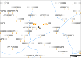
Wān Hsang (Shan, Myanmar)Wān Hsang is a town in the Shan region of Myanmar. An overview map of the region around Wān Hsang is displayed below.
regional and 3d topo map of Wān Hsang, Myanmar ::
Wān Hsang airports ::
The nearest airport is KET - Kengtung, located 135.0 km west of Wān Hsang.
Other airports nearby include THL - Tachilek Tachileik (145.1 km south west), MOG - Mong Hsat (199.9 km south west), LPQ - Luang Prabang Luang Phabang Intl (209.8 km south east), Nearby towns ::
Wān Hin (1.7km west) //
Wān Ra-sa-pu-hkam (2.5km north east) //
Möng Hkan (3.5km west) //
Wān Hatrāng (3.7km south) //
Wān Na-yao-taü (5.2km west) //
Wān Na-mōk (5.5km west) //
Wān Haw (5.5km west) //
Wān Na-yao-nö (5.5km west) //
Wān Sa-pi-sai (5.8km north) //
Wān Sa-inta (6.5km north west) //
Wān Pā-hka (6.9km east) //
Ban Xay (7.1km east) //
Ban Pia Nam Khine (7.6km south) //
Wān Bōk-aw (7.8km south west) //
Wān Sa-hpūmma (8.9km south west) //
Ban Xiangkheng (9.0km south west) //
[all distances 'as the bird flies' and approximate] 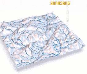 Places with similar names to Wān Hsang, Myanmar ::
// Winzing (AT)
// Winsing (DE)
// Wŏnsang (KP)
// Wŏnasŏng (KR)
// Wŏnsaeng (KR)
// Wān Hsenkao (MM)
// Wan Sing (MM)
// Wān Hsenhkiao (MM)
// Wān Hsonhka (MM)
// Wān Ai-süng (MM)
Disclaimer :: Information on this page comes without warranty of any kind |
||
|
Where is Wān Hsang? Elevation and coordinates ::
Latitude (lat): 21°24'0"N Longitude (lon): 100°56'0"E
Elevation (approx.): 1134m (map arrows pan, magnifying glasses zoom) |
||
|
Visiting Wān Hsang? Hotel/Accommodation ::
Book a hotel in Wān Hsang Travel Guide ::
Buy a travel guide for Myanmar rental cars ::
car rental offers GPS waypoint ::
download a GPX waypoint (PoI) of Wān Hsang for your GPS receiver
|
||