|
search place name
|
||
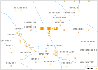
Wān Maklā (Shan, Myanmar)Wān Maklā is a town in the Shan region of Myanmar. An overview map of the region around Wān Maklā is displayed below.
regional and 3d topo map of Wān Maklā, Myanmar ::
Wān Maklā airports ::
The nearest airport is MOG - Mong Hsat, located 33.8 km west of Wān Maklā.
Other airports nearby include THL - Tachilek Tachileik (37.2 km east), KET - Kengtung (90.9 km north), Nearby towns ::
Wān Pinghkām (0.1km west) //
Wān Mōng (0.8km north) //
Wān Hki-tūt (0.8km south east) //
Möng Htā-lāng (1.0km north) //
Wān Ho-nā (1.5km north) //
Wān Yāng (1.7km north) //
Wān Nawngmawng (2.1km north) //
Wān Hsenhkamhsao (5.0km west) //
Wān Hsa-tōng (5.4km south) //
Wān Pa-hōk (5.4km north east) //
Wān Möng Kwannoi (5.6km south east) //
Wān Hsenhko (5.7km east) //
Wān Möng Hawm (6.2km south) //
Wān Ho-nā (6.5km south) //
Wān Ra-sa-paw-i (6.8km north east) //
Möng Kwan (7.0km south east) //
Wān Tinhtat (7.0km south) //
Wān Ra-sa-hkü (6.8km west) //
Wān Kūn (7.2km south) //
Wān Pa-wōng (7.5km south) //
Wān Lōng (7.5km south) //
Wān Kūnpūng (7.8km south) //
Wān Pawmüng (7.8km north) //
Wān Pangmaw (7.5km north west) //
Wān Mē-sōk (7.8km south west) //
Wān Mōng (8.0km south) //
Wān Pu-keng (8.1km south) //
Wān Hwè-tāt (8.6km south) //
Wān Yanghā (8.2km south west) //
[all distances 'as the bird flies' and approximate] 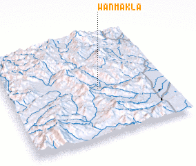 Places with similar names to Wān Maklā, Myanmar :: Disclaimer :: Information on this page comes without warranty of any kind |
||
|
Where is Wān Maklā? Elevation and coordinates ::
Latitude (lat): 20°28'58"N Longitude (lon): 99°34'45"E
Elevation (approx.): 595m (map arrows pan, magnifying glasses zoom) |
||
|
Visiting Wān Maklā? Hotel/Accommodation ::
Book a hotel in Wān Maklā Travel Guide ::
Buy a travel guide for Myanmar rental cars ::
car rental offers GPS waypoint ::
download a GPX waypoint (PoI) of Wān Maklā for your GPS receiver
|
||