|
search place name
|
||
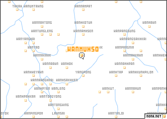
Wān Muhsö (Shan, Myanmar)Wān Muhsö is a town in the Shan region of Myanmar. An overview map of the region around Wān Muhsö is displayed below.
regional and 3d topo map of Wān Muhsö, Myanmar ::
Wān Muhsö airports ::
The nearest airport is KET - Kengtung, located 63.0 km east of Wān Muhsö.
Other airports nearby include MOG - Mong Hsat (110.6 km south), THL - Tachilek Tachileik (144.3 km south east), LSH - Lashio (212.5 km north west), Nearby towns ::
Wān Ngeknawk (2.5km north east) //
Yang Pong (3.7km south) //
Wān Hük (3.9km north west) //
Wān Hok (3.9km south west) //
Wān Namhsen (5.6km north) //
Wān Hsakhken (6.5km south west) //
Wān Hkō-tum (7.4km north) //
Wān Nā-awn (7.1km west) //
Wān Tawngloi (7.6km north west) //
Wān Htap (7.8km south east) //
Wān Hwè-mawn (8.2km south east) //
Wān Leng (9.0km south west) //
Wān Kūt (9.0km south east) //
Wān Nawng (8.9km north west) //
Wān Na-hkawn (8.9km south west) //
[all distances 'as the bird flies' and approximate]  Places with similar names to Wān Muhsö, Myanmar ::
// Wanamassa (US)
// Wān Muhsö (MM)
// Wān Mèsai (MM)
// Wān Muhsö (MM)
// Wān Muh-hso (MM)
// Wān Muhsö (MM)
// Wān Namhsai (MM)
// Wān Namhsai (MM)
// Wān Namhsi (MM)
// Wān Namhsoi (MM)
Disclaimer :: Information on this page comes without warranty of any kind |
||
|
Where is Wān Muhsö? Elevation and coordinates ::
Latitude (lat): 21°30'0"N Longitude (lon): 99°4'0"E
Elevation (approx.): 1481m (map arrows pan, magnifying glasses zoom) |
||
|
Visiting Wān Muhsö? Hotel/Accommodation ::
Book a hotel in Wān Muhsö Travel Guide ::
Buy a travel guide for Myanmar rental cars ::
car rental offers GPS waypoint ::
download a GPX waypoint (PoI) of Wān Muhsö for your GPS receiver
|
||