|
search place name
|
||
Ouled Bende (Boumerdes, Algeria)Ouled Bende is a town in the Boumerdes region of Algeria. An overview map of the region around Ouled Bende is displayed below.
regional and 3d topo map of Ouled Bende, Algeria ::

Ouled Bende airports ::
The nearest airport is ALG - Algier Houari Boumediene, located 34.1 km west of Ouled Bende.
Other airports nearby include BJA - Bejaja Soummam (133.3 km east), Nearby towns ::
Ouled el Bar (1.0km south east) //
Ouled Ahmed Ben Ali (1.6km south east) //
Ouled Ben Younes (1.8km west) //
Aïn Benaâmane (2.0km south west) //
Zemmouri (2.2km east) //
Zemmouri el Bahri (2.6km north west) //
Ouled Hocine (2.8km south) //
Douar Zaâtra (3.1km south east) //
Benhammouch (2.7km west) //
Zaâtra (3.0km south east) //
Ouled Mohammed Ben Ahmed (3.3km south west) //
Bir Zaâtra (4.0km south east) //
Ouled Mnassir (4.6km south west) //
Hadj Ben Abid (5.2km east) //
Thenia (6.5km south) //
El Karma (5.7km west) //
Si Mustapha (7.2km south east) //
Ben Abid (6.5km east) //
Ouled Abdelkrim (7.0km west) //
Koudiet el Araiss (7.5km east) //
Beni Fouda (10.2km south west) //
[all distances 'as the bird flies' and approximate] 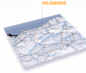 Places with similar names to Ouled Bende, Algeria ::
// Oulad Ben Ayyad (MA)
// Oulad Benayyad (MA)
// Oulad Ben Addou (MA)
// Oulad ben Daoui (MA)
// Oulad Ben Ittou (MA)
// Ouled Banndou (DZ)
// Ouled Ben Aouda (DZ)
Disclaimer :: Information on this page comes without warranty of any kind |
||
|
Where is Ouled Bende? Elevation and coordinates ::
Latitude (lat): 36°46'57"N Longitude (lon): 3°34'46"E
Elevation (approx.): 61m (map arrows pan, magnifying glasses zoom) |
||
|
Visiting Ouled Bende? Hotel/Accommodation ::
Book a hotel in Ouled Bende Travel Guide ::
Buy a travel guide for Algeria rental cars ::
car rental offers GPS waypoint ::
download a GPX waypoint (PoI) of Ouled Bende for your GPS receiver
|
||