|
search place name
|
||
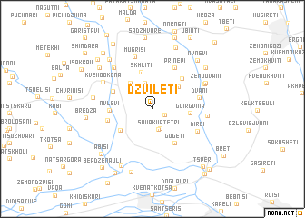
Dzviletʼi (Kʼarelis Raioni, Georgia)Dzviletʼi is a town in the Kʼarelis Raioni region of Georgia. An overview map of the region around Dzviletʼi is displayed below.
regional and 3d topo map of Dzviletʼi, Georgia ::
Nearby towns ::
Zemo-Kvatetri (1.3km south east) //
Lashe (2.4km south) //
Shua-Kvatetri (2.5km south) //
Korugi (3.3km north) //
Veleyebi (3.6km north east) //
Zemo-Okona (3.8km north west) //
Gvirgvina (3.5km east) //
Skhliti (4.7km north) //
Tamarasheni (3.9km south west) //
Gogeti (4.7km south east) //
Chorbauli (4.6km north east) //
Avlevi (3.9km west) //
Knolevi (4.2km north west) //
Tseronisi (4.3km west) //
Prinevi (5.5km north) //
Dvani (4.5km east) //
Dirbi (5.0km south east) //
Takhtisdziri (5.0km east) //
Mugrisi (6.7km north) //
Kvemo-Okona (5.6km north west) //
Qornisi (6.2km north west) //
Muguti (5.7km north east) //
Zemo-Dvani (5.8km north east) //
Atotsʼi (5.6km west) //
Pʼtsʼa (7.6km south) //
Nuli (7.9km north) //
Nabakevi (7.3km north west) //
Kvemo-Shakshaketi (8.0km south) //
Avnevi (7.3km north east) //
[all distances 'as the bird flies' and approximate] 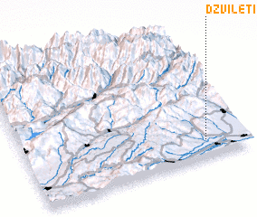 Places with similar names to Dzviletʼi, Georgia ::
Disclaimer :: Information on this page comes without warranty of any kind |
||
|
Where is Dzviletʼi? Elevation and coordinates ::
Latitude (lat): 42°8'16"N Longitude (lon): 43°49'30"E
Elevation (approx.): 900m (map arrows pan, magnifying glasses zoom) |
||
|
Visiting Dzviletʼi? Hotel/Accommodation ::
Book a hotel in Dzviletʼi Travel Guide ::
Buy a travel guide for Georgia rental cars ::
car rental offers GPS waypoint ::
download a GPX waypoint (PoI) of Dzviletʼi for your GPS receiver
|
||