|
search place name
|
||
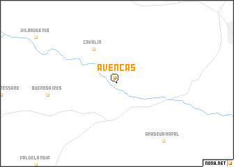
Avencas (São Paulo, Brazil)Avencas is a town in the São Paulo region of Brazil. An overview map of the region around Avencas is displayed below.
regional and 3d topo map of Avencas, Brazil ::
Avencas airports ::
The nearest airport is LIP - Lins, located 79.3 km north east of Avencas.
Other airports nearby include BAU - Bauru (109.7 km east), ARU - Aracatuba (130.4 km north), PPB - President Prudente Presidente Prudente (135.4 km west), LDB - Londrina (156.1 km south west), Nearby towns ::
Cavalin (6.5km north west) //
[all distances 'as the bird flies' and approximate] 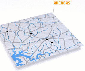 Places with similar names to Avencas, Brazil ::
// Ấp Hương Sa (VN)
// Āfe Nigus (ET)
Disclaimer :: Information on this page comes without warranty of any kind |
||
|
Where is Avencas? Elevation and coordinates ::
Latitude (lat): 22°17'0"S Longitude (lon): 50°7'0"W
Elevation (approx.): 473m (map arrows pan, magnifying glasses zoom) |
||
|
Visiting Avencas? Hotel/Accommodation ::
Book a hotel in Avencas Travel Guide ::
Buy a travel guide for Brazil rental cars ::
car rental offers GPS waypoint ::
download a GPX waypoint (PoI) of Avencas for your GPS receiver
|
||