|
search place name
|
||
Ponta Curuá (Amapá, Brazil)Ponta Curuá is a town in the Amapá region of Brazil. An overview map of the region around Ponta Curuá is displayed below.
regional and 3d topo map of Ponta Curuá, Brazil ::

Ponta Curuá airports ::
The nearest airport is MCP - Macapa, located 118.6 km south west of Ponta Curuá.
Nearby towns ::
[all distances 'as the bird flies' and approximate] 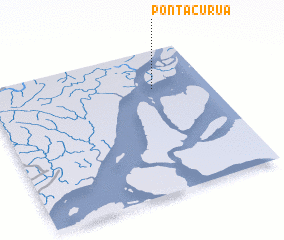 Places with similar names to Ponta Curuá, Brazil ::
// Ponto Carro (PT)
// Puente Agüero (ES)
// Pondokeurih (ID)
// Pandácuareo (MX)
// Pendakaré (SN)
// Pandogari (NG)
// Pantikare (NG)
// Panti Kura (NG)
// Pontcarré (FR)
// Pentacre (US)
Disclaimer :: Information on this page comes without warranty of any kind |
||
|
Where is Ponta Curuá? Elevation and coordinates ::
Latitude (lat): 0°44'0"S Longitude (lon): 50°15'0"W
(map arrows pan, magnifying glasses zoom) |
||
|
Visiting Ponta Curuá? Hotel/Accommodation ::
Book a hotel in Ponta Curuá Travel Guide ::
Buy a travel guide for Brazil rental cars ::
car rental offers GPS waypoint ::
download a GPX waypoint (PoI) of Ponta Curuá for your GPS receiver
|
||