|
search place name
|
||
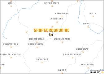
São Pedro da União (Minas Gerais, Brazil)São Pedro da União is a town in the Minas Gerais region of Brazil. An overview map of the region around São Pedro da União is displayed below.
regional and 3d topo map of São Pedro da União, Brazil ::
São Pedro da União airports ::
The nearest airport is POO - Pocos De Caldas, located 78.7 km south of São Pedro da União.
Other airports nearby include QPS - Piracununga Campo Fontenelle (120.1 km south west), RAO - Ribeirao Preto Leite Lopes (120.2 km west), VAG - Varginha Major Brigadeiro Trompowsky (128.9 km south east), AQA - Araracuara Araraquara (174.2 km south west), Nearby towns ::
Antônio Roque (3.7km north) //
Gabriel Martins (3.9km south east) //
Oscar Resende (5.5km west) //
João Balbino (5.8km north) //
Antônio Spineli (6.4km south west) //
Pessegueiro (8.2km north east) //
Miguel Longuinho (10.1km south east) //
[all distances 'as the bird flies' and approximate] 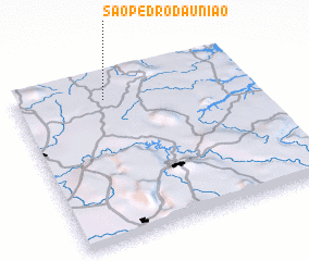 Places with similar names to São Pedro da União, Brazil :: Disclaimer :: Information on this page comes without warranty of any kind |
||
|
Where is São Pedro da União? Elevation and coordinates ::
Latitude (lat): 21°8'0"S Longitude (lon): 46°37'0"W
Elevation (approx.): 1026m (map arrows pan, magnifying glasses zoom) |
||
|
Visiting São Pedro da União? Hotel/Accommodation ::
Book a hotel in São Pedro da União Travel Guide ::
Buy a travel guide for Brazil rental cars ::
car rental offers GPS waypoint ::
download a GPX waypoint (PoI) of São Pedro da União for your GPS receiver
|
||