|
search place name
|
||
Vila Brasil (São Paulo, Brazil)Vila Brasil is a town in the São Paulo region of Brazil. An overview map of the region around Vila Brasil is displayed below.
regional and 3d topo map of Vila Brasil, Brazil ::

Vila Brasil airports ::
The nearest airport is VCP - Campinas Viracopos, located 41.1 km south east of Vila Brasil.
Other airports nearby include QPS - Piracununga Campo Fontenelle (84.9 km north), GRU - Sao Paulo Guarulhos Gov Andre Franco Montouro (123.4 km south east), CGH - Sao Paulo Congonhas (125.0 km south east), AQA - Araracuara Araraquara (127.0 km north west), Nearby towns ::
Santa Bárbara dʼOeste (0.7km east) //
Vila Oliveira (1.3km east) //
Barreiro (4.5km south east) //
Jardim Europa (5.4km north east) //
Caiubi (5.3km west) //
Galvão (5.8km south) //
Bom Retiro (6.0km south) //
Barrocão (6.5km north east) //
Jardim Ipiranga (6.4km east) //
São Roque (6.8km east) //
Pinheirinho (7.3km north west) //
Lambari de Baixo (7.6km south west) //
Quebra-Dente (8.4km west) //
Lambari do Meio (8.7km south west) //
Taimbé (9.7km north west) //
Invernada (10.0km south west) //
[all distances 'as the bird flies' and approximate] 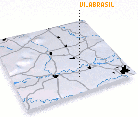 Places with similar names to Vila Brasil, Brazil ::
// Valea Abruzel (RO)
// Villa Bruzual (VE)
// Vila Brasil (BR)
// Vila Brasil (BR)
// Villa Barcelo (AR)
Disclaimer :: Information on this page comes without warranty of any kind |
||
|
Where is Vila Brasil? Elevation and coordinates ::
Latitude (lat): 22°44'51"S Longitude (lon): 47°25'13"W
Elevation (approx.): 560m (map arrows pan, magnifying glasses zoom) |
||
|
Visiting Vila Brasil? Hotel/Accommodation ::
Book a hotel in Vila Brasil Travel Guide ::
Buy a travel guide for Brazil rental cars ::
car rental offers GPS waypoint ::
download a GPX waypoint (PoI) of Vila Brasil for your GPS receiver
|
||