|
search place name
|
||
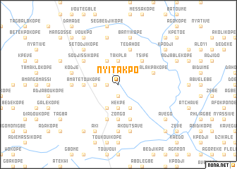
Nyitakpo (Togo)Nyitakpo is a town in Togo. An overview map of the region around Nyitakpo is displayed below.
regional and 3d topo map of Nyitakpo, Togo ::
Nyitakpo airports ::
The nearest airport is LFW - Lome Gnassingbe Eyadema Intl, located 63.5 km south east of Nyitakpo.
Other airports nearby include ACC - Accra Kotoka Intl (162.7 km south west), COO - Cotonou Cadjehoun (166.7 km east), Nearby towns ::
Anyavé (1.9km south) //
Agobaba (1.8km west) //
Agoniokopé (1.9km south) //
Koudassi (3.7km west) //
Takpla (3.7km north) //
Hékpé (3.7km south) //
Agotimé (4.1km north west) //
Kpétavi (4.1km north west) //
Dassikopé (4.1km south east) //
Adigbli (4.1km south west) //
Tsipé (5.2km north east) //
Tovégan (5.6km south) //
Zongo (5.6km south) //
Amatétoukopé (5.5km west) //
Koudassi (5.5km west) //
Alakpa Kopé (5.8km east) //
Adjakakopé (5.8km east) //
Agbessia (5.9km south) //
Aményoukpé (5.9km south) //
Tédahoé (5.9km north) //
Sodjissikopé (6.7km north west) //
Doudokpoé (7.4km south) //
Bémé (7.4km west) //
Banyi Kopé (7.6km north) //
Dafounoukopé (7.6km north) //
Kodjé (7.6km west) //
Akoutsavé (7.6km south) //
Sétodji Kopé (7.8km north west) //
Amoussokopé (7.8km north west) //
[all distances 'as the bird flies' and approximate] 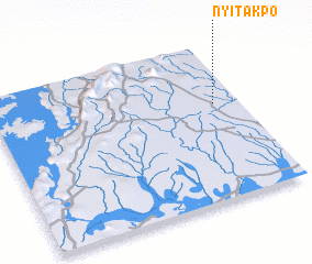 Places with similar names to Nyitakpo, Togo ::
// Nyatikpo (GH)
Disclaimer :: Information on this page comes without warranty of any kind |
||
|
Where is Nyitakpo? Elevation and coordinates ::
Latitude (lat): 6°37'0"N Longitude (lon): 0°54'0"W
Elevation (approx.): 103m (map arrows pan, magnifying glasses zoom) |
||
|
Visiting Nyitakpo? Hotel/Accommodation ::
Book a hotel in Nyitakpo Travel Guide ::
Buy a travel guide for Togo rental cars ::
car rental offers GPS waypoint ::
download a GPX waypoint (PoI) of Nyitakpo for your GPS receiver
|
||