|
search place name
|
||
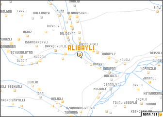
Alıbǝyli (Zǝngilan, Azerbaijan)Alıbǝyli is a town in the Zǝngilan region of Azerbaijan. An overview map of the region around Alıbǝyli is displayed below.
regional and 3d topo map of Alıbǝyli, Azerbaijan ::
Alıbǝyli airports ::
The nearest airport is TBZ - Tabriz Intl, located 122.3 km south of Alıbǝyli.
Nearby towns ::
Rǝbǝnd (1.3km north) //
Alybeyli Vtoryye (1.2km south east) //
Saryl (2.2km south east) //
Birinci Ağalı (2.7km north east) //
İkinci Ağalı (2.7km north east) //
Selǝli (3.8km north) //
Üçüncü Ağalı (3.1km north east) //
Qiyaslı (3.1km west) //
Xocahan (3.7km north west) //
Tatar (3.3km west) //
Xumarlı (3.8km south east) //
Zilanlı (4.6km north) //
Tinli (4.9km north west) //
Gilidzhan (5.4km north west) //
Kürd Mahrızlı (6.0km north) //
Qaraqoyunlu (4.9km west) //
Babayly (4.9km east) //
Şarifan (5.9km south east) //
Qaralar (7.1km north) //
Əbılcǝ (7.0km north west) //
Mahrızlı (7.8km north) //
Mǝmmǝdbǝyli (6.2km east) //
Ulaşlı (7.7km north west) //
Hacıalılı (7.2km south east) //
Muğanlı (8.4km north) //
Muğanlı (8.5km south) //
Kavdadıq (8.7km north) //
Kiyasly (8.2km north west) //
Genanly (8.6km south east) //
[all distances 'as the bird flies' and approximate] 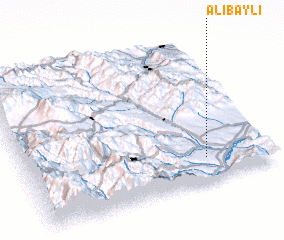 Places with similar names to Alıbǝyli, Azerbaijan ::
Disclaimer :: Information on this page comes without warranty of any kind |
||
|
Where is Alıbǝyli? Elevation and coordinates ::
Latitude (lat): 39°9'44"N Longitude (lon): 46°44'24"E
Elevation (approx.): 340m (map arrows pan, magnifying glasses zoom) |
||
|
Visiting Alıbǝyli? Hotel/Accommodation ::
Book a hotel in Alıbǝyli Travel Guide ::
Buy a travel guide for Azerbaijan rental cars ::
car rental offers GPS waypoint ::
download a GPX waypoint (PoI) of Alıbǝyli for your GPS receiver
|
||