|
search place name
|
||
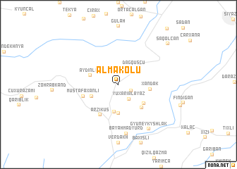
Əlmǝkolu (Siyǝzǝn, Azerbaijan)Əlmǝkolu is a town in the Siyǝzǝn region of Azerbaijan. An overview map of the region around Əlmǝkolu is displayed below.
regional and 3d topo map of Əlmǝkolu, Azerbaijan ::
Əlmǝkolu airports ::
The nearest airport is BAK - Baku Heydar Aliyev, located 108.9 km south east of Əlmǝkolu.
Other airports nearby include MCX - Makhachkala Uytash (230.4 km north west), Nearby towns ::
Palkhash (1.8km south east) //
Yuxarı Alayaz (2.6km south east) //
Dağ Quşçu (3.2km north east) //
Güneşlı (4.4km south) //
Günǝvşa (4.5km south) //
Köhnǝ Quşçu (3.7km south west) //
Aydinlar (3.7km north west) //
Yanıq Alayaz (4.3km south east) //
Xǝndǝk (3.8km east) //
Qaragöz (4.6km south east) //
Allahyarlı (4.6km south east) //
Ərziküş (5.3km south west) //
Mustafaxanlı (4.6km south west) //
Bǝyǝhmǝdyurd (7.8km south) //
Gyuneykyshlak (7.9km south east) //
Saqolcan (8.7km north east) //
Mümgülqazma (10.6km north east) //
[all distances 'as the bird flies' and approximate]  Places with similar names to Əlmǝkolu, Azerbaijan ::
// Al Miqallah (EG)
// Al Mukaḩḩal (SA)
// Al Mukaylī (SA)
// Ālam Kili (PK)
// Almae-gol (KP)
// Al Maqla‘ (SY)
// Al Ma‘qul (OM)
// Al Ma‘qil (IQ)
// ‘Alam Kolā (IR)
// Al Ma‘qil (YE)
Disclaimer :: Information on this page comes without warranty of any kind |
||
|
Where is Əlmǝkolu? Elevation and coordinates ::
Latitude (lat): 40°59'0"N Longitude (lon): 48°57'0"E
Elevation (approx.): 1032m (map arrows pan, magnifying glasses zoom) |
||
|
Visiting Əlmǝkolu? Hotel/Accommodation ::
Book a hotel in Əlmǝkolu Travel Guide ::
Buy a travel guide for Azerbaijan rental cars ::
car rental offers GPS waypoint ::
download a GPX waypoint (PoI) of Əlmǝkolu for your GPS receiver
|
||