|
search place name
|
||
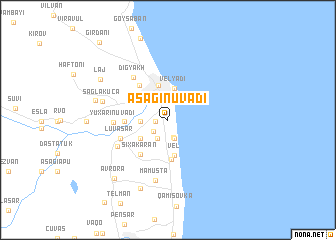
Aşağı Nüvǝdi (Lǝnkǝran, Azerbaijan)Aşağı Nüvǝdi is a town in the Lǝnkǝran region of Azerbaijan. An overview map of the region around Aşağı Nüvǝdi is displayed below.
regional and 3d topo map of Aşağı Nüvǝdi, Azerbaijan ::
Aşağı Nüvǝdi airports ::
The nearest airport is RAS - Rasht, located 167.9 km south east of Aşağı Nüvǝdi.
Other airports nearby include BAK - Baku Heydar Aliyev (219.3 km north east), RZR - Ramsar (256.8 km south east), Nearby towns ::
Gǝrmǝtük (1.1km west) //
Viyan (1.8km south west) //
Kǝnarǝmeşǝ (2.0km south) //
Seydǝkǝran (2.1km south) //
Türkǝkǝran (2.3km south west) //
Sütǝmurdov (2.7km north) //
Güvǝnil (2.4km west) //
Velyadi (3.5km north) //
Bala Şürük (3.1km south west) //
Vel (4.0km south) //
Lǝnkǝran (4.0km north) //
Xolmili (4.4km south) //
Tütǝpǝştǝ (3.8km west) //
Şıxakǝran (4.6km south west) //
Şilavar (4.6km north west) //
Lüvǝsǝr (4.6km south west) //
Digyakh (5.6km north west) //
Yuxarı Nüvǝdi (4.8km west) //
Şürük (5.3km south west) //
Mamusta (6.9km south) //
Şağlakücǝ (6.0km west) //
Tǝzǝkǝnd (8.0km south) //
Kǝrgǝlan (6.7km west) //
Lǝj (7.4km north west) //
Avrora (8.0km south west) //
Girdǝni (10.5km north west) //
[all distances 'as the bird flies' and approximate]  Places with similar names to Aşağı Nüvǝdi, Azerbaijan :: Disclaimer :: Information on this page comes without warranty of any kind |
||
|
Where is Aşağı Nüvǝdi? Elevation and coordinates ::
Latitude (lat): 38°43'7"N Longitude (lon): 48°51'38"E
Elevation (approx.): -18m (map arrows pan, magnifying glasses zoom) |
||
|
Visiting Aşağı Nüvǝdi? Hotel/Accommodation ::
Book a hotel in Aşağı Nüvǝdi Travel Guide ::
Buy a travel guide for Azerbaijan rental cars ::
car rental offers GPS waypoint ::
download a GPX waypoint (PoI) of Aşağı Nüvǝdi for your GPS receiver
|
||