|
search place name
|
||
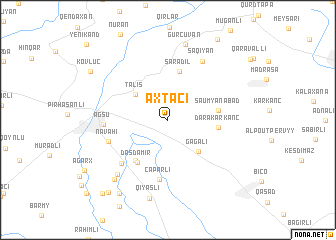
Axtaçı (Ağsu, Azerbaijan)Axtaçı is a town in the Ağsu region of Azerbaijan. An overview map of the region around Axtaçı is displayed below.
regional and 3d topo map of Axtaçı, Azerbaijan ::
Axtaçı airports ::
The nearest airport is BAK - Baku Heydar Aliyev, located 134.5 km east of Axtaçı.
Nearby towns ::
Mırtı (2.8km north east) //
Kadzhar (3.0km north west) //
Talış (4.0km north west) //
Gǝgǝli (4.4km south east) //
Şǝrǝdil (5.6km north) //
Dǝrǝkǝrkǝnc (4.4km east) //
Şaumyanabad (4.4km east) //
Qaramǝmmǝdli (5.3km south west) //
Daşdǝmir (5.4km south west) //
Çaparlı (6.7km south) //
Ərǝbuşağı (6.2km south west) //
Navahı (5.6km south west) //
Ağsu (5.5km west) //
Saqiyan (7.2km north east) //
Ağalarbǝyli (7.5km south west) //
Gürcüvǝn (8.6km north) //
Rǝhimağalı (8.1km south west) //
Qiyaslı (8.9km south) //
Ağabeyli (9.2km south west) //
İkinci Aratkǝnd (9.2km south west) //
Kövlüc (8.5km north west) //
Qaraqaşlı (9.6km south west) //
Birinci Aratkǝnd (9.9km south west) //
[all distances 'as the bird flies' and approximate]  Places with similar names to Axtaçı, Azerbaijan ::
// Agostas (PT)
// Agostos (PT)
// Auksūdys (LT)
// Auksūdys (LT)
// Augustus (US)
// Augusto Sa (MZ)
// Augusto Seio (BR)
// Axtaçı (AZ)
// Axtaçı (AZ)
// Axtaçı (AZ)
Disclaimer :: Information on this page comes without warranty of any kind |
||
|
Where is Axtaçı? Elevation and coordinates ::
Latitude (lat): 40°34'27"N Longitude (lon): 48°27'56"E
Elevation (approx.): 438m (map arrows pan, magnifying glasses zoom) |
||
|
Visiting Axtaçı? Hotel/Accommodation ::
Book a hotel in Axtaçı Travel Guide ::
Buy a travel guide for Azerbaijan rental cars ::
car rental offers GPS waypoint ::
download a GPX waypoint (PoI) of Axtaçı for your GPS receiver
|
||