|
search place name
|
||
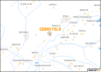
Göbǝktala (İmişli, Azerbaijan)Göbǝktala is a town in the İmişli region of Azerbaijan. An overview map of the region around Göbǝktala is displayed below.
regional and 3d topo map of Göbǝktala, Azerbaijan ::
Göbǝktala airports ::
The nearest airport is TBZ - Tabriz Intl, located 241.5 km south west of Göbǝktala.
Nearby towns ::
Şǝhverdili (2.5km south west) //
Rǝsullu (3.2km north east) //
Qaradonlu (3.8km south east) //
Khub”yarly (4.3km south) //
Mamedli (3.6km east) //
Boşçalılar (4.2km west) //
Mǝzrǝli (5.2km south) //
Chakhar (4.6km east) //
Gëkharli (4.7km east) //
Yalavadzh (5.5km north east) //
Çaxırlı (7.7km south) //
Hacıbabalı (7.7km south) //
Qaralar (6.5km east) //
Soltanmuradly (6.6km east) //
İmişli (7.7km north east) //
Olcalar (6.8km east) //
Bir May (8.5km south west) //
Otuziki (7.8km north east) //
Bǝhramtǝpǝ (9.1km south west) //
[all distances 'as the bird flies' and approximate]  Places with similar names to Göbǝktala, Azerbaijan :: Disclaimer :: Information on this page comes without warranty of any kind |
||
|
Where is Göbǝktala? Elevation and coordinates ::
Latitude (lat): 39°48'45"N Longitude (lon): 48°0'30"E
Elevation (approx.): 3m (map arrows pan, magnifying glasses zoom) |
||
|
Visiting Göbǝktala? Hotel/Accommodation ::
Book a hotel in Göbǝktala Travel Guide ::
Buy a travel guide for Azerbaijan rental cars ::
car rental offers GPS waypoint ::
download a GPX waypoint (PoI) of Göbǝktala for your GPS receiver
|
||