|
search place name
|
||
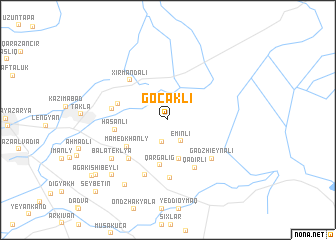
Göcǝkli (Masallı, Azerbaijan)Göcǝkli is a town in the Masallı region of Azerbaijan. An overview map of the region around Göcǝkli is displayed below.
regional and 3d topo map of Göcǝkli, Azerbaijan ::
Göcǝkli airports ::
The nearest airport is BAK - Baku Heydar Aliyev, located 185.8 km north east of Göcǝkli.
Other airports nearby include RAS - Rasht (212.9 km south), Nearby towns ::
Shagriyar (2.5km south) //
Eminli (2.6km south east) //
Arab (2.8km north west) //
Dellyakli (4.4km south) //
Qarğalıg (5.1km south) //
Mamedkhanly (4.6km south west) //
Khoshchobanly (4.6km north west) //
Hǝsǝnli (4.7km west) //
Qǝdirli (5.8km south east) //
Kyurdabazly (5.5km south west) //
Xırmandalı (5.5km north west) //
Gadzhytepe (5.0km west) //
Mollagasanli (5.0km west) //
Khallydzhaly (6.5km south) //
Gadzhi-Eynali (5.7km south east) //
Alyshanly (6.5km south) //
Bala Teklya (6.5km south west) //
Etchelyar (8.1km south west) //
Samedkhanly Pervyye (7.8km south west) //
Agakishibeyli (8.8km south west) //
Sǝrǝfǝ (9.1km south west) //
Seybetin (10.2km south west) //
[all distances 'as the bird flies' and approximate]  Places with similar names to Göcǝkli, Azerbaijan ::
Disclaimer :: Information on this page comes without warranty of any kind |
||
|
Where is Göcǝkli? Elevation and coordinates ::
Latitude (lat): 39°7'20"N Longitude (lon): 48°45'22"E
Elevation (approx.): -22m (map arrows pan, magnifying glasses zoom) |
||
|
Visiting Göcǝkli? Hotel/Accommodation ::
Book a hotel in Göcǝkli Travel Guide ::
Buy a travel guide for Azerbaijan rental cars ::
car rental offers GPS waypoint ::
download a GPX waypoint (PoI) of Göcǝkli for your GPS receiver
|
||