|
search place name
|
||
İmamqulubǝyli (Ağdam, Azerbaijan)İmamqulubǝyli is a town in the Ağdam region of Azerbaijan. An overview map of the region around İmamqulubǝyli is displayed below.
regional and 3d topo map of İmamqulubǝyli, Azerbaijan ::
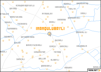
Nearby towns ::
Çullu (2.2km south) //
Əmirli (4.1km north) //
Quzanlı (3.8km south east) //
Evazlı (5.0km south) //
Şǝrǝfli (4.9km north east) //
İlxıçılar (5.7km north) //
Soğanverdilǝr (6.4km north) //
Xanǝrǝb (6.0km north east) //
Baharlı (6.2km south west) //
Sarıcalı (6.4km south east) //
Piyadalar (7.2km north) //
Sǝrkarlar (6.0km north east) //
Birinci Yuzbaşlı (6.4km south west) //
İkinci Yuzbaşlı (7.7km south) //
Taynaq (7.5km south) //
Hüseynli (6.3km north west) //
Xındırıstan (7.7km south west) //
Orta Qǝrvǝnd (6.5km west) //
Bǝcirǝvan (6.8km north east) //
Gadzhally (7.0km west) //
Poladlı (8.9km south east) //
Əhmǝdağalı (9.1km south west) //
Sarıçoban (9.5km south west) //
Qaradǝmirçi (8.8km north east) //
[all distances 'as the bird flies' and approximate] 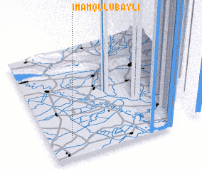 Places with similar names to İmamqulubǝyli, Azerbaijan ::
// İmamqulubǝyli (AZ)
Disclaimer :: Information on this page comes without warranty of any kind |
||
|
Where is İmamqulubǝyli? Elevation and coordinates ::
Latitude (lat): 40°11'8"N Longitude (lon): 47°8'33"E
Elevation (approx.): 98m (map arrows pan, magnifying glasses zoom) |
||
|
Visiting İmamqulubǝyli? Hotel/Accommodation ::
Book a hotel in İmamqulubǝyli Travel Guide ::
Buy a travel guide for Azerbaijan rental cars ::
car rental offers GPS waypoint ::
download a GPX waypoint (PoI) of İmamqulubǝyli for your GPS receiver
|
||