|
search place name
|
||
Kiçik Əmili (Qǝbǝlǝ, Azerbaijan)Kiçik Əmili is a town in the Qǝbǝlǝ region of Azerbaijan. An overview map of the region around Kiçik Əmili is displayed below.
regional and 3d topo map of Kiçik Əmili, Azerbaijan ::

Kiçik Əmili airports ::
The nearest airport is MCX - Makhachkala Uytash, located 218.7 km north of Kiçik Əmili.
Nearby towns ::
Zalam (1.8km south east) //
Mollaşıxalı (2.4km south east) //
Sırt Yenigicǝ (3.2km north east) //
Böyük Pirǝli (3.4km west) //
Soltannuxa (4.5km north) //
Böyük Əmili (3.5km west) //
Hacıalılı (4.5km west) //
Mamaylı (5.1km south west) //
Topbağ (5.3km south east) //
Tövlǝ (5.8km north west) //
Bayramkoxalı (6.9km south) //
Böyük Pirǝli (7.1km north) //
Şamlı (5.5km west) //
Bılıx (6.2km south east) //
Ovcullu (7.0km south west) //
Yengica (6.4km east) //
Aydınqışlaq (8.5km north) //
Mǝlikli (7.7km south east) //
Silǝyli (8.3km south east) //
Mirzǝbǝyli (9.8km north west) //
[all distances 'as the bird flies' and approximate] 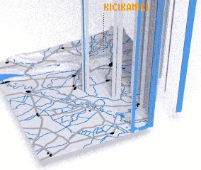 Places with similar names to Kiçik Əmili, Azerbaijan ::
Disclaimer :: Information on this page comes without warranty of any kind |
||
|
Where is Kiçik Əmili? Elevation and coordinates ::
Latitude (lat): 40°50'59"N Longitude (lon): 47°46'52"E
Elevation (approx.): 373m (map arrows pan, magnifying glasses zoom) |
||
|
Visiting Kiçik Əmili? Hotel/Accommodation ::
Book a hotel in Kiçik Əmili Travel Guide ::
Buy a travel guide for Azerbaijan rental cars ::
car rental offers GPS waypoint ::
download a GPX waypoint (PoI) of Kiçik Əmili for your GPS receiver
|
||