|
search place name
|
||
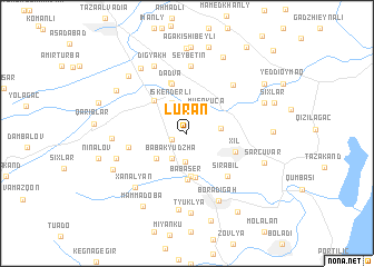
Lürǝn (Masallı, Azerbaijan)Lürǝn is a town in the Masallı region of Azerbaijan. An overview map of the region around Lürǝn is displayed below.
regional and 3d topo map of Lürǝn, Azerbaijan ::
Lürǝn airports ::
The nearest airport is BAK - Baku Heydar Aliyev, located 201.7 km north east of Lürǝn.
Other airports nearby include RAS - Rasht (201.7 km south east), Nearby towns ::
Dellyakoba (1.3km south west) //
Qızılavar (2.8km south) //
Babakyudzha (2.7km south west) //
Musakücǝ (2.7km north east) //
Göyǝçöl (2.7km east) //
Iskenderli (3.3km north) //
Böyük Külatan (3.5km south west) //
Ashurlu (4.3km south) //
Bǝdǝlan (4.4km south) //
Babaser (4.7km south) //
Ərkivan (4.2km north west) //
Dadva (5.1km north) //
Xıl (4.3km south east) //
Masallı (5.2km north) //
Sirabil (5.4km south east) //
Qodman (4.8km west) //
Ondzhakyala (6.1km north east) //
Seybetin (6.8km north) //
Mamedrzakyudzha (6.0km south west) //
Xanalyan (6.8km south west) //
Boradigah (7.2km south) //
Əzizabad (5.9km west) //
Digyakh (7.3km north) //
Qǝzvinoba (7.7km south) //
Këgna Alvady (7.4km north west) //
Tyuklya (8.0km south) //
Banbaşı (7.3km north west) //
Sǝrçuvar (6.7km south east) //
Sığdaş (6.8km south west) //
[all distances 'as the bird flies' and approximate] 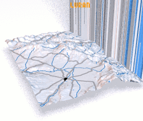 Places with similar names to Lürǝn, Azerbaijan ::
Disclaimer :: Information on this page comes without warranty of any kind |
||
|
Where is Lürǝn? Elevation and coordinates ::
Latitude (lat): 38°59'20"N Longitude (lon): 48°40'48"E
Elevation (approx.): -11m (map arrows pan, magnifying glasses zoom) |
||
|
Visiting Lürǝn? Hotel/Accommodation ::
Book a hotel in Lürǝn Travel Guide ::
Buy a travel guide for Azerbaijan rental cars ::
car rental offers GPS waypoint ::
download a GPX waypoint (PoI) of Lürǝn for your GPS receiver
|
||