|
search place name
|
||
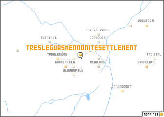
Tres Leguas Mennonite Settlement (Orange Walk, Belize)Tres Leguas Mennonite Settlement is a town in the Orange Walk region of Belize. An overview map of the region around Tres Leguas Mennonite Settlement is displayed below.
regional and 3d topo map of Tres Leguas Mennonite Settlement, Belize ::
Tres Leguas Mennonite Settlement airports ::
The nearest airport is BZE - Belize City Philip S W Goldson Intl, located 73.4 km south east of Tres Leguas Mennonite Settlement.
Other airports nearby include CTM - Chetumal Intl (91.7 km north east), CPE - Campeche Ingeniero Alberto Acuna Ongay Intl (272.5 km north west), Nearby towns ::
Rosita (1.8km west) //
Gnadenthal (2.6km south west) //
Neuendorf (2.6km north east) //
Blue Creek Village (3.5km east) //
Gnadenfeld (4.0km south west) //
Reinland (4.0km south east) //
Blumenfeld (4.1km south west) //
Dos Bocas (5.1km north east) //
Tres Leguas (5.3km west) //
Estero Franco (6.6km north east) //
Edenthal (8.0km north west) //
[all distances 'as the bird flies' and approximate]  Places with similar names to Tres Leguas Mennonite Settlement, Belize :: Disclaimer :: Information on this page comes without warranty of any kind |
||
|
Where is Tres Leguas Mennonite Settlement? Elevation and coordinates ::
Latitude (lat): 17°53'0"N Longitude (lon): 88°54'0"W
Elevation (approx.): 87m (map arrows pan, magnifying glasses zoom) |
||
|
Visiting Tres Leguas Mennonite Settlement? Hotel/Accommodation ::
Book a hotel in Tres Leguas Mennonite Settlement Travel Guide ::
Buy a travel guide for Belize rental cars ::
car rental offers GPS waypoint ::
download a GPX waypoint (PoI) of Tres Leguas Mennonite Settlement for your GPS receiver
|
||