|
search place name
|
||
Cancañiri (La Paz, Bolivia)Cancañiri is a town in the La Paz region of Bolivia. An overview map of the region around Cancañiri is displayed below.
regional and 3d topo map of Cancañiri, Bolivia ::

Cancañiri airports ::
The nearest airport is JUL - Juliaca, located 113.6 km west of Cancañiri.
Other airports nearby include LPB - La Paz El Alto Intl (151.2 km south east), Nearby towns ::
Cascachle (1.8km east) //
Hualpacollo (2.6km north east) //
Humanata (4.0km north west) //
Coriquina (4.1km north east) //
Quili Huyo (5.8km north) //
Quirimia (7.1km west) //
Pacaures (7.6km south) //
Italaque (8.2km north east) //
Saihuani (8.0km north east) //
[all distances 'as the bird flies' and approximate] 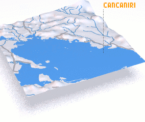 Places with similar names to Cancañiri, Bolivia ::
// Konganur (RU)
// Kangnéra (TD)
// Kanakanūr (IN)
// Kānkināra (IN)
// Gungo Nair (SD)
// Quenequenero (VE)
// Kangno-ri (KP)
// Kunikunira (PG)
// Konganur (RU)
// Kānganr (PK)
Disclaimer :: Information on this page comes without warranty of any kind |
||
|
Where is Cancañiri? Elevation and coordinates ::
Latitude (lat): 15°28'0"S Longitude (lon): 69°6'0"W
Elevation (approx.): 4063m (map arrows pan, magnifying glasses zoom) |
||
|
Visiting Cancañiri? Hotel/Accommodation ::
Book a hotel in Cancañiri Travel Guide ::
Buy a travel guide for Bolivia rental cars ::
car rental offers GPS waypoint ::
download a GPX waypoint (PoI) of Cancañiri for your GPS receiver
|
||