|
search place name
|
||
San Antonio de Pitacollo (Oruro, Bolivia)San Antonio de Pitacollo is a town in the Oruro region of Bolivia. An overview map of the region around San Antonio de Pitacollo is displayed below.
regional and 3d topo map of San Antonio de Pitacollo, Bolivia ::

San Antonio de Pitacollo airports ::
The nearest airport is ARI - Arica Chacalluta, located 200.8 km north west of San Antonio de Pitacollo.
Other airports nearby include TCQ - Tacna Coronel Carlos Ciriani Santa Rosa Intl (210.0 km north west), IQQ - Iquique Diego Aracena Intl (234.7 km south west), Nearby towns ::
Canguana (6.4km south east) //
La Rivera (7.9km north west) //
Estancia Camaquene (9.9km north west) //
Estancia Wichu Khana (9.9km north west) //
[all distances 'as the bird flies' and approximate] 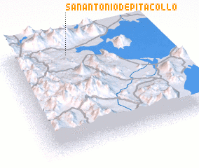 Places with similar names to San Antonio de Pitacollo, Bolivia :: Disclaimer :: Information on this page comes without warranty of any kind |
||
|
Where is San Antonio de Pitacollo? Elevation and coordinates ::
Latitude (lat): 19°3'0"S Longitude (lon): 68°35'0"W
Elevation (approx.): 3816m (map arrows pan, magnifying glasses zoom) |
||
|
Visiting San Antonio de Pitacollo? Hotel/Accommodation ::
Book a hotel in San Antonio de Pitacollo Travel Guide ::
Buy a travel guide for Bolivia rental cars ::
car rental offers GPS waypoint ::
download a GPX waypoint (PoI) of San Antonio de Pitacollo for your GPS receiver
|
||