|
search place name
|
||
Nkaganzogou (Cameroon)Nkaganzogou is a town in Cameroon. An overview map of the region around Nkaganzogou is displayed below.
regional and 3d topo map of Nkaganzogou, Cameroon ::

Nkaganzogou airports ::
The nearest airport is DLA - Douala, located 41.8 km north of Nkaganzogou.
Other airports nearby include TKC - Tiko (68.9 km north west), SSG - Malabo (120.1 km west), BSG - Bata (191.1 km south), YAO - Yaounde Ville (194.6 km east), Nearby towns ::
Mouanko (1.0km north west) //
Lobétal (1.3km north) //
Yavi (1.8km south east) //
Botoudé (2.0km south west) //
Ndog Mongo (2.4km north) //
Bolounga (2.6km south west) //
Npombo (2.6km south west) //
Yadibo II (3.8km north) //
Yatou (4.0km east) //
Abé (4.1km north east) //
Yadibo I (5.2km north east) //
Yalou (5.6km north) //
Mbango (5.8km south east) //
Yankuzok (6.0km south east) //
Bondjadi (6.3km south west) //
Eben (6.7km south west) //
Elog Nsogwouti (7.0km north west) //
Moulongo (7.5km south west) //
Nya Mbong (7.6km north) //
Mbanga (7.6km east) //
Boy (7.9km south west) //
Elog Banag (8.6km north west) //
Bohengué (9.8km south west) //
Ngola (10.9km south west) //
[all distances 'as the bird flies' and approximate] 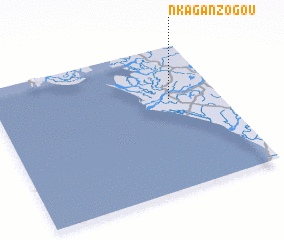 Places with similar names to Nkaganzogou, Cameroon ::
// Nkecnsoc (GQ)
Disclaimer :: Information on this page comes without warranty of any kind |
||
|
Where is Nkaganzogou? Elevation and coordinates ::
Latitude (lat): 3°38'0"N Longitude (lon): 9°47'0"E
Elevation (approx.): 5m (map arrows pan, magnifying glasses zoom) |
||
|
Visiting Nkaganzogou? Hotel/Accommodation ::
Book a hotel in Nkaganzogou Travel Guide ::
Buy a travel guide for Cameroon rental cars ::
car rental offers GPS waypoint ::
download a GPX waypoint (PoI) of Nkaganzogou for your GPS receiver
|
||