|
search place name
|
||
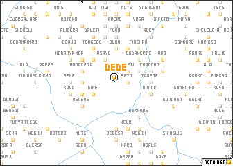
Dēdē (Ethiopia)Dēdē is a town in Ethiopia. An overview map of the region around Dēdē is displayed below.
regional and 3d topo map of Dēdē, Ethiopia ::
Dēdē airports ::
The nearest airport is ADD - Addis Ababa Bole Intl, located 65.9 km south of Dēdē.
Other airports nearby include JIM - Jimma (288.8 km south west), Nearby towns ::
Hārērē (1.9km north) //
Seyo (1.8km east) //
Kʼētʼel (2.6km north east) //
Daletī (2.6km north east) //
Kʼerē Kʼunī (2.6km north east) //
Āsayo (4.1km north west) //
Gībē (4.1km south west) //
Melkē (4.1km north east) //
Yasa (4.1km north east) //
Kʼotʼemī (5.2km north west) //
Denjo (5.2km north west) //
Goda Werkʼē (5.2km north east) //
Gogola (5.2km north east) //
Dīmo (5.5km west) //
Tokē (5.5km west) //
Buku (5.6km north) //
Tamene (5.5km east) //
Bona Gena (5.8km west) //
Gomē (5.8km west) //
Kʼwat (5.8km west) //
Gīrēnchʼī (5.8km west) //
Kʼatʼila (5.9km north) //
Bondē (5.8km east) //
Chʼanchʼo (5.8km east) //
Burkʼa Jebī (6.7km north west) //
Tʼengego (6.7km north west) //
Gobeya (6.6km north west) //
Mererē (6.6km south west) //
Gobola (6.7km north east) //
[all distances 'as the bird flies' and approximate] 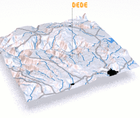 Places with similar names to Dēdē, Ethiopia ::
Disclaimer :: Information on this page comes without warranty of any kind |
||
|
Where is Dēdē? Elevation and coordinates ::
Latitude (lat): 9°33'0"N Longitude (lon): 38°38'0"E
Elevation (approx.): 1848m (map arrows pan, magnifying glasses zoom) |
||
|
Visiting Dēdē? Hotel/Accommodation ::
Book a hotel in Dēdē Travel Guide ::
Buy a travel guide for Ethiopia rental cars ::
car rental offers GPS waypoint ::
download a GPX waypoint (PoI) of Dēdē for your GPS receiver
|
||