|
search place name
|
||
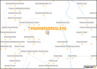
Phumĭ Ândong Slêng (Kâmpóng Cham, Cambodia)Phumĭ Ândong Slêng is a town in the Kâmpóng Cham region of Cambodia. An overview map of the region around Phumĭ Ândong Slêng is displayed below.
regional and 3d topo map of Phumĭ Ândong Slêng, Cambodia ::
Phumĭ Ândong Slêng airports ::
The nearest airport is PNH - Phnom-penh Phnom Penh Intl, located 125.7 km west of Phumĭ Ândong Slêng.
Other airports nearby include SGN - Ho Chi Minh City Tansonnhat Intl (138.9 km south east), Nearby towns ::
Phumĭ Krâsăng (4.1km north east) //
Phumĭ Dâmbâng Peăk (4.1km south west) //
Phumĭ Ph'av (5.2km north west) //
Phumĭ Trâbêk (5.7km west) //
Phumĭ Kâmpăh (5.7km west) //
Phumĭ Srê Vêng (6.6km north east) //
Phumĭ Tœ̆k Chrŏu (6.6km north west) //
Phumĭ Véal Mlu (6.6km south west) //
Phumĭ Mémay (6.6km south east) //
Phumĭ Koŭk Srâlau (7.6km north) //
Phumĭ Ĕnt Nĭmĭtt (7.5km west) //
Phumĭ Pôpél (7.5km west) //
Phumĭ Krêk (7.6km south) //
Phumĭ Trâpeăng Chrey (8.1km north west) //
Phumĭ Krânhung (9.2km south west) //
Phumĭ Sâmakôm Kausu Khmêr (9.1km south east) //
Phumĭ Tahiĕv Kraôm (10.4km south west) //
[all distances 'as the bird flies' and approximate]  Places with similar names to Phumĭ Ândong Slêng, Cambodia :: Disclaimer :: Information on this page comes without warranty of any kind |
||
|
Where is Phumĭ Ândong Slêng? Elevation and coordinates ::
Latitude (lat): 11°52'0"N Longitude (lon): 105°57'0"E
Elevation (approx.): 90m (map arrows pan, magnifying glasses zoom) |
||
|
Visiting Phumĭ Ândong Slêng? Hotel/Accommodation ::
Book a hotel in Phumĭ Ândong Slêng Travel Guide ::
Buy a travel guide for Cambodia rental cars ::
car rental offers GPS waypoint ::
download a GPX waypoint (PoI) of Phumĭ Ândong Slêng for your GPS receiver
|
||