|
search place name
|
||
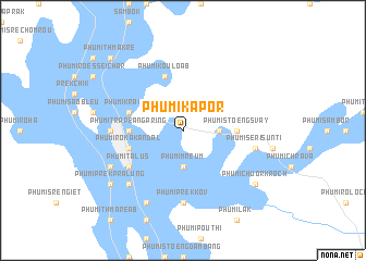
Phumĭ Kapor (Krâchéh, Cambodia)Phumĭ Kapor is a town in the Krâchéh region of Cambodia. An overview map of the region around Phumĭ Kapor is displayed below.
regional and 3d topo map of Phumĭ Kapor, Cambodia ::
Phumĭ Kapor airports ::
The nearest airport is PNH - Phnom-penh Phnom Penh Intl, located 170.1 km south west of Phumĭ Kapor.
Other airports nearby include SGN - Ho Chi Minh City Tansonnhat Intl (194.3 km south), Nearby towns ::
Phumĭ Mreum (3.7km south) //
Phumĭ Dar (3.6km east) //
Phumĭ Ânhchanh (3.6km east) //
Phumĭ Stœ̆ng Svay (5.4km east) //
Phumĭ Trâpeăng Pring (5.4km west) //
Phumĭ Koŭ Loăb (5.8km north) //
Phumĭ Rôka Kândal (5.7km west) //
Phumĭ Krâkôr (5.7km west) //
Phumĭ Ta Lŭs (6.6km south west) //
Phumĭ Péam Té (6.6km south west) //
Phumĭ Prêk Kov (7.4km south) //
Krâchéh (7.2km west) //
Phumĭ Chŏng Kaôh (7.2km west) //
Phumĭ Khsa (7.5km east) //
Phumĭ Sĕri Sŭntĭ (7.5km east) //
Phumĭ Khviĕn (7.8km south west) //
Phumĭ Bŏs Léav (8.2km south west) //
Phumĭ Saôb Kraôm (8.1km south west) //
Phumĭ Prêk Prâlung (9.1km south west) //
Phumĭ Chuŏr Kroch (9.1km south east) //
Phumĭ Thmâ Krê (10.4km north west) //
[all distances 'as the bird flies' and approximate] 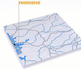 Places with similar names to Phumĭ Kapor, Cambodia :: Disclaimer :: Information on this page comes without warranty of any kind |
||
|
Where is Phumĭ Kapor? Elevation and coordinates ::
Latitude (lat): 12°29'0"N Longitude (lon): 106°5'0"E
Elevation (approx.): 33m (map arrows pan, magnifying glasses zoom) |
||
|
Visiting Phumĭ Kapor? Hotel/Accommodation ::
Book a hotel in Phumĭ Kapor Travel Guide ::
Buy a travel guide for Cambodia rental cars ::
car rental offers GPS waypoint ::
download a GPX waypoint (PoI) of Phumĭ Kapor for your GPS receiver
|
||