|
search place name
|
||
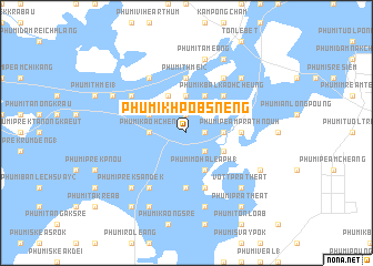
Phumĭ Khpôb Snêng (Kâmpóng Cham, Cambodia)Phumĭ Khpôb Snêng is a town in the Kâmpóng Cham region of Cambodia. An overview map of the region around Phumĭ Khpôb Snêng is displayed below.
regional and 3d topo map of Phumĭ Khpôb Snêng, Cambodia ::
Phumĭ Khpôb Snêng airports ::
The nearest airport is PNH - Phnom-penh Phnom Penh Intl, located 73.6 km south west of Phumĭ Khpôb Snêng.
Other airports nearby include SGN - Ho Chi Minh City Tansonnhat Intl (180.2 km south east), REP - Siem-reap Siem Reap (241.4 km north west), Nearby towns ::
Phumĭ Chihê (1.8km east) //
Phumĭ Chŏng Kaôh Cheung (1.9km north) //
Phumĭ Pôngrô (2) (2.6km south east) //
Phumĭ Păk Nam (2.6km south east) //
Phumĭ Tuŏl Svay Chrŭm (2.6km south east) //
Phumĭ Kaôh Kól (3.7km north) //
Phumĭ Ânlóng (3.6km east) //
Phumĭ Kaôh Chĕn (3.6km west) //
Phumĭ Kaôh Prâlung (4.1km north east) //
Phumĭ Môha Léaph (1) (4.1km south east) //
Phumĭ Kaôh Kŏk Krau (4.1km north west) //
Phumĭ Prêk Rumdéng (2) (4.1km south east) //
Phumĭ Kâmpóng Réab (4.1km north west) //
Phumĭ Kbal Kaôh Cheung (5.2km north east) //
Phumĭ Kaôh Rôkar (5.6km north) //
Phumĭ Thmei (2) (5.6km north) //
Phumĭ Tumpung (5.6km south) //
Phumĭ Péam Prâthnoŭh (5.4km east) //
Phumĭ Rôka Kaông (5.8km south) //
Phumĭ Kôkôr (6.6km north west) //
Phumĭ Kâmpóng Krâbei (6.6km north west) //
Phumĭ Kaôh Pên (6.6km north east) //
Phumĭ Kaôh Rôkar Cham (6.6km north west) //
Phumĭ Lvé (6.6km south west) //
Phumĭ Ta Méang (7.6km north) //
Phumĭ Dâmnăk Pring (7.6km south) //
Phumĭ Prêk Sândêk (7.8km south west) //
Phumĭ Don Mau Kraôm (7.8km north east) //
Vôtt Prâthéat (7.8km south east) //
[all distances 'as the bird flies' and approximate] 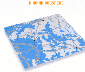 Places with similar names to Phumĭ Khpôb Snêng, Cambodia :: Disclaimer :: Information on this page comes without warranty of any kind |
||
|
Where is Phumĭ Khpôb Snêng? Elevation and coordinates ::
Latitude (lat): 11°54'0"N Longitude (lon): 105°25'0"E
Elevation (approx.): 16m (map arrows pan, magnifying glasses zoom) |
||
|
Visiting Phumĭ Khpôb Snêng? Hotel/Accommodation ::
Book a hotel in Phumĭ Khpôb Snêng Travel Guide ::
Buy a travel guide for Cambodia rental cars ::
car rental offers GPS waypoint ::
download a GPX waypoint (PoI) of Phumĭ Khpôb Snêng for your GPS receiver
|
||