|
search place name
|
||
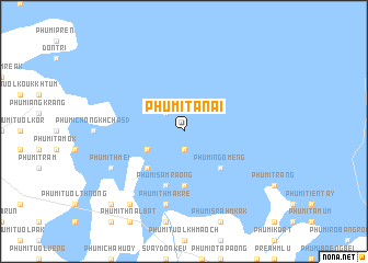
Phumĭ Ta Nai (Poŭthĭsăt, Cambodia)Phumĭ Ta Nai is a town in the Poŭthĭsăt region of Cambodia. An overview map of the region around Phumĭ Ta Nai is displayed below.
regional and 3d topo map of Phumĭ Ta Nai, Cambodia ::
Phumĭ Ta Nai airports ::
The nearest airport is REP - Siem-reap Siem Reap, located 71.6 km north of Phumĭ Ta Nai.
Other airports nearby include PNH - Phnom-penh Phnom Penh Intl (188.7 km south east), Nearby towns ::
Phumĭ Ângkănh (1.9km south) //
Phumĭ Sdŏk Khloŭk (1.9km south) //
Phumĭ 'Neăkta Tvéa (2.6km north west) //
Phumĭ Tuŏl Téahéan (4.1km south west) //
Phumĭ Ngôméng (5.2km south east) //
Phumĭ Chrab (5.2km south west) //
Phumĭ Mâ Vêng (2) (5.6km south) //
Phumĭ Sâmraông (5.8km south) //
Phumĭ Chroŭy (5.8km south) //
Phumĭ Thmâ Krê (7.6km south) //
Phumĭ Thmei (8.1km south west) //
Phumĭ Koăs Kânáb (9.2km south west) //
Phumĭ Kô Kaông (10.4km south west) //
[all distances 'as the bird flies' and approximate] 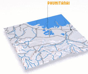 Places with similar names to Phumĭ Ta Nai, Cambodia ::
// Phumĭ Don Au (KH)
// Phumĭ Don Ĕ (KH)
// Phumĭ Don Néa (KH)
// Phumĭ Don Noy (KH)
// Phumĭ Don Noy (KH)
// Phumĭ Ta An (KH)
// Phumĭ Ta Ĕn (KH)
// Phumĭ Tanei (KH)
// Phumĭ Ta Ney (KH)
// Phumĭ Ta Ni (KH)
Disclaimer :: Information on this page comes without warranty of any kind |
||
|
Where is Phumĭ Ta Nai? Elevation and coordinates ::
Latitude (lat): 12°47'0"N Longitude (lon): 103°39'0"E
Elevation (approx.): 8m (map arrows pan, magnifying glasses zoom) |
||
|
Visiting Phumĭ Ta Nai? Hotel/Accommodation ::
Book a hotel in Phumĭ Ta Nai Travel Guide ::
Buy a travel guide for Cambodia rental cars ::
car rental offers GPS waypoint ::
download a GPX waypoint (PoI) of Phumĭ Ta Nai for your GPS receiver
|
||