|
search place name
|
||
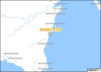
Phumĭ Ta Tei (Kaôh Kŏng, Cambodia)Phumĭ Ta Tei is a town in the Kaôh Kŏng region of Cambodia. An overview map of the region around Phumĭ Ta Tei is displayed below.
regional and 3d topo map of Phumĭ Ta Tei, Cambodia ::
Phumĭ Ta Tei airports ::
The nearest airport is PNH - Phnom-penh Phnom Penh Intl, located 165.5 km east of Phumĭ Ta Tei.
Nearby towns ::
Phumĭ Srê Trav (2) (4.1km south west) //
Phumĭ Prêk Krâsăng (2) (4.1km north east) //
Phumĭ Prêk Krâsăng (1) (7.6km north) //
[all distances 'as the bird flies' and approximate]  Places with similar names to Phumĭ Ta Tei, Cambodia ::
// Phumĭ Dei Dŏh (KH)
// Phumĭ Tadé (KH)
// Phumĭ Ta Tai (KH)
// Phumĭ Tatay (KH)
// Phumĭ Titŭy (KH)
// Phumĭ Tôtéa (KH)
// Phumĭ Tôtéa (KH)
// Phum Tatée (VN)
Disclaimer :: Information on this page comes without warranty of any kind |
||
|
Where is Phumĭ Ta Tei? Elevation and coordinates ::
Latitude (lat): 11°0'0"N Longitude (lon): 103°26'0"E
Elevation (approx.): -32768m (map arrows pan, magnifying glasses zoom) |
||
|
Visiting Phumĭ Ta Tei? Hotel/Accommodation ::
Book a hotel in Phumĭ Ta Tei Travel Guide ::
Buy a travel guide for Cambodia rental cars ::
car rental offers GPS waypoint ::
download a GPX waypoint (PoI) of Phumĭ Ta Tei for your GPS receiver
|
||