|
search place name
|
||
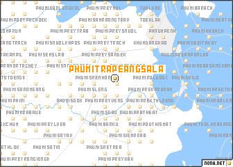
Phumĭ Trâpeăng Sala (Bântéay Méan Cheăy, Cambodia)Phumĭ Trâpeăng Sala is a town in the Bântéay Méan Cheăy region of Cambodia. An overview map of the region around Phumĭ Trâpeăng Sala is displayed below.
regional and 3d topo map of Phumĭ Trâpeăng Sala, Cambodia ::
Phumĭ Trâpeăng Sala airports ::
The nearest airport is PNH - Phnom-penh Phnom Penh Intl, located 7.0 km north of Phumĭ Trâpeăng Sala.
Other airports nearby include SGN - Ho Chi Minh City Tansonnhat Intl (210.1 km east), REP - Siem-reap Siem Reap (241.2 km north west), Nearby towns ::
Phumĭ Kâmriĕng (0.0km north) //
Phumĭ Trâpeăng Châk (1.9km south) //
Phumĭ Trâpeăng Kák (1.9km north) //
Phumĭ Pông Tœ̆k (2.6km south west) //
Phumĭ Toăp Baôh (2.6km south west) //
Phumĭ Prey Spœ (2.6km north west) //
Phumĭ Ângk Titŭy (2.6km north east) //
Phumĭ Prey Sâr (2.6km north east) //
Phumĭ Prâkar (2.6km north east) //
Phumĭ Koŭk Khsăch (3.6km west) //
Phumĭ Srê Nhôr (3.6km west) //
Phumĭ Slêng (4.1km south west) //
Phumĭ Ha (4.1km south east) //
Phumĭ Ânlóng Kông (4.1km south east) //
Phumĭ Prey Vêng (4.1km south west) //
Phumĭ Káb Phlŭk (4.1km north west) //
Phumĭ Prey Kâmbŏt (4.1km north west) //
Phumĭ Krăng (4.1km south east) //
Phumĭ Khvĕt (4.1km south east) //
Phumĭ Prey Sândêk (4.1km north west) //
Phumĭ Koŭk Krâsăng (5.2km south east) //
Phumĭ Krăng Dontey (5.2km north west) //
Phumĭ Phleung Chhéh Rôtéh (5.4km west) //
Phumĭ Kóng Nôy (5.6km south) //
Khŭm Chaômchau (5.6km north) //
Phumĭ Cheung Êk (5.4km east) //
Phumĭ Rôluŏs (2) (5.4km east) //
Phumĭ Prâteăh Lang (5.8km west) //
Phumĭ Prêk Prânak (5.8km east) //
[all distances 'as the bird flies' and approximate]  Places with similar names to Phumĭ Trâpeăng Sala, Cambodia ::
// Phumĭ Trâpeăng Sala (KH)
// Phumĭ Trâpeăng Sala (KH)
// Phumĭ Trâpeăng Sala (KH)
// Phumĭ Trâpeăng Sla (KH)
// Phumĭ Trâpeăng Sla (KH)
// Phumĭ Trâpeăng S'ŏy Leu (KH)
// Phum Trâpeăng Sala (VN)
Disclaimer :: Information on this page comes without warranty of any kind |
||
|
Where is Phumĭ Trâpeăng Sala? Elevation and coordinates ::
Latitude (lat): 11°29'0"N Longitude (lon): 104°51'0"E
Elevation (approx.): 11m (map arrows pan, magnifying glasses zoom) |
||
|
Visiting Phumĭ Trâpeăng Sala? Hotel/Accommodation ::
Book a hotel in Phumĭ Trâpeăng Sala Travel Guide ::
Buy a travel guide for Cambodia rental cars ::
car rental offers GPS waypoint ::
download a GPX waypoint (PoI) of Phumĭ Trâpeăng Sala for your GPS receiver
|
||