|
search place name
|
||
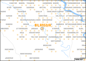
Bīl Āngdia (Barisāl, Bangladesh)Bīl Āngdia is a town in the Barisāl region of Bangladesh. An overview map of the region around Bīl Āngdia is displayed below.
regional and 3d topo map of Bīl Āngdia, Bangladesh ::
Bīl Āngdia airports ::
The nearest airport is IRD - Ishurdi, located 41.2 km north of Bīl Āngdia.
Other airports nearby include JSR - Jessore (66.7 km south), RJH - Rajshahi Shah Mokhdum (87.5 km north west), DAC - Dhaka Zia Intl (132.4 km east), CCU - Calcutta Netaji Subhash Chandra Bose Intl (141.8 km south west), Nearby towns ::
Gaznabipur (0.0km north) //
Ujangrām (0.0km north) //
Hātia (1.7km west) //
Āstānagar (1.7km west) //
Mādhpur (1.7km east) //
Buzurg Bākhail (1.9km north) //
Gopālpur (2.5km south west) //
Deripāra (2.5km south west) //
Harinārāyanpur (2.5km south east) //
Pānthāpāra (2.5km south east) //
Mahisādānga (2.5km south east) //
Bākhail Khurd (2.5km north west) //
Sonāidānga (2.5km north east) //
Jhāudia (3.4km west) //
Shāhāpur (3.7km south) //
Bāruipāra (3.4km east) //
Durbāchāra (3.4km east) //
Ālampur (3.7km north) //
Kāsināthpùr (3.9km south west) //
Bākchua Lakshmtpur (4.1km south west) //
Paschim Ābdālpur (4.1km south west) //
Kirtinagar (4.1km south east) //
Lakshmīpur (4.1km south east) //
Baraitupi (3.9km north east) //
Kānchanpur (4.1km north east) //
Tailtupi (5.0km south west) //
Dahakula (5.0km north west) //
Chāpāigāchhi (5.0km north west) //
Mājpāra (5.1km west) //
[all distances 'as the bird flies' and approximate]  Places with similar names to Bīl Āngdia, Bangladesh ::
Disclaimer :: Information on this page comes without warranty of any kind |
||
|
Where is Bīl Āngdia? Elevation and coordinates ::
Latitude (lat): 23°47'0"N Longitude (lon): 89°6'0"E
Elevation (approx.): 15m (map arrows pan, magnifying glasses zoom) |
||
|
Visiting Bīl Āngdia? Hotel/Accommodation ::
Book a hotel in Bīl Āngdia Travel Guide ::
Buy a travel guide for Bangladesh rental cars ::
car rental offers GPS waypoint ::
download a GPX waypoint (PoI) of Bīl Āngdia for your GPS receiver
|
||